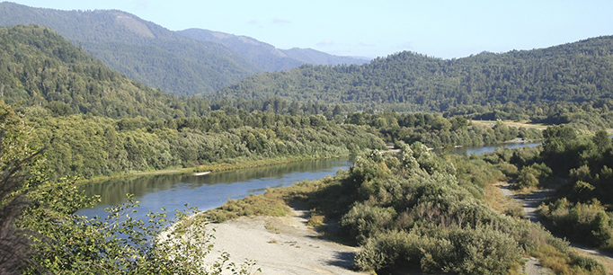
The Yuba Accord: A Model for Water Management

Last week a diverse group of stakeholders celebrated the tenth anniversary of the Lower Yuba River Accord—a historic agreement to improve conditions for the river’s endangered fishes, maintain water supplies for cities and farms, and reduce conflict over competing uses for water. Here at the PPIC Water Policy Center we frequently refer to the Yuba Accord as a model for modern water management in California. Here are three reasons why.

  1. Cooperation: The Yuba Accord happened because parties came together to develop an alternative plan in response to a state order calling for more water to support endangered salmon. By leveraging local management tools—including increased use of groundwater on farms during droughts—the accord has kept even more water in the river for fish than the state called for. This is a great example of how negotiated agreements can get broad buy-in and tap on-the-ground knowledge.
  2. Integration: Integrated water management gets better results by examining all the pieces of the water puzzle together to see how solutions to one problem might affect other areas. The Yuba Accord is a very effective example of this. The accord hinges on the flexibility achieved by managing surface water and groundwater as an integrated system to benefit salmon. But the augmented river flows provide additional benefits in Yuba County and beyond. The accord authorizes flows downstream of the Yuba to be traded to agricultural and urban communities farther south who face shortages during dry years. Moreover, the revenue generated by water trades has helped fund flood protection upgrades in Yuba County—an area facing high flood risk.
  3. Planning ahead: The accord demonstrates the advantages of planning for different hydrologic conditions. Careful work went into deciding how surface water and groundwater would be managed in wet and dry years. This meant that during the 2012–16 drought the Yuba was one of few watersheds in the state that was prepared to weather the extended dry conditions. California needs more such watershed-level plans for managing water for ecosystems before, during, and after droughts.

To be sure, Yuba County stakeholders started out with some advantages: in addition to relatively abundant water supplies, the county has a governance structure that makes integrated water management easier to implement. The Yuba County Water Agency (YCWA) is a county-wide special district whose board consists of county supervisors—local leaders for all county matters, not just for water. YCWA is responsible for both surface water delivery and flood management, and its boundaries overlap with the local groundwater basin. YCWA also had some very committed leaders who wanted to find a creative alternative to a protracted legal battle over flow regulations.

Even so, other California watersheds could adopt the accord’s focus on integrated, cooperative planning. One near-term opportunity lies in the implementation of the Sustainable Groundwater Management Act (SGMA), a state law that requires local water districts to bring their basins into balance but leaves it to the locals to decide how to achieve that goal. Another opportunity lies in improving conditions for fish and wildlife in Central Valley rivers as part of the update to the Water Quality Control Plan for the Bay–Delta. The State Water Board is proposing regulations to increase river flows, but is also inviting parties to propose alternatives that take a more holistic approach. This offers locals a chance to leverage the new groundwater management authorities under SGMA to integrate the management of groundwater and surface water. These kinds of pragmatic, consensus-based approaches can generate long-term solutions to some of the toughest challenges in California water.
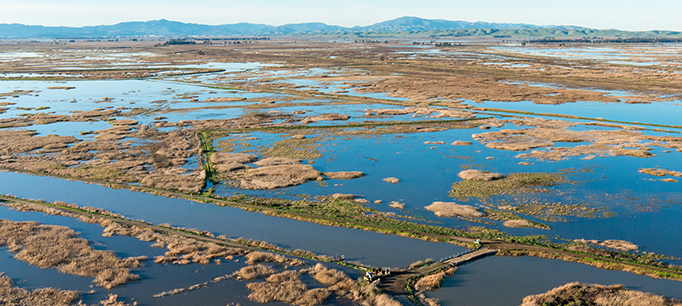

Watch a short video about the accord.

Why We Need Working Floodplains

Floodplains are hard-working landscapes when they’re allowed to “act naturally.” But their flood-taming, habitat-feeding abilities are compromised when they’re paved over or constricted by levees. We talked with Josh Viers, a watershed scientist at UC Merced and a member of the PPIC Water Policy Center research network, about restoring floodplains.

PPIC: What happens when rivers are given more room to flood?

Josh Viers: River systems are highly dynamic—they’re always changing in time and space. As they rush from their headwaters, they break down mountains and transport a lot of sediment. By the time they reach the lowlands, they’ve started to deposit that sediment. It’s that dynamic between water and land that creates floodplains. Humans like to inhabit floodplains because of their rich soil and flat land. So we’ve engineered ways to protect people from floodwaters. But ecosystems evolved to have functions and processes that depend on floods. For example, flood flows are slower and warmer on floodplains. That creates good conditions for a lot of creatures―bugs, fishes, and birds, for example. When we cut off rivers from their floodplain, we’re cutting off these essential habitat functions.

We now recognize that giving rivers room to flood can have many beneficial outcomes. Dynamic river systems that are allowed to flood result in more complex habitats and more productive ecosystems. There’s a growing effort to reconnect floodplains to their rivers—for example, by setting back or breaching sections of levees. The most immediate benefit is a reduction in flood hazards downstream because you store some floodwater and some of the sediment that constricts channels on the floodplain. There are also ecosystem benefits. As more nutrient-rich sediments are deposited on the floodplain, they’re colonized by riparian plants, feeding whole communities of insects, birds, and other animals. Floodplains are also incubators for native fishes. Fishes on floodplains get much fatter than those that remain in the river, which can translate into better reproductive success. Floodwaters in floodplains can also recharge local groundwater supply, and they facilitate the long-term sequestration of carbon by burying plant matter with sediments deposited on the floodplain.

PPIC: Where is floodplain restoration underway?

JV: I’ve been part of a team of scientists looking at floodplain restoration on the Lower Cosumnes River near Sacramento. This river has no major dam on it so it has a relatively natural flow regime, including relatively frequent floods. We’ve studied how its floodplain responds to reconnection with flood waters after its levees were set back. And we’ve documented that setting back levees and allowing rivers to flood have multiple benefits for habitat and groundwater recharge while maintaining flood protection. The lessons from the Cosumnes are informing similar efforts in other locations—the Sacramento, San Joaquin, and Feather rivers are having some levees set back in strategic locations.

One of the more remarkable recent floodplain restoration projects is located at the confluence of the San Joaquin and Tuolumne rivers. Federal and state agencies have worked with landowners and conservation organizations to integrate flood protection and habitat creation through levee enhancements and the acquisition of key floodplain lands. The results have not only benefitted fish and bird populations, but also provided room for the rivers to behave more naturally in a location that has historically had large river meanders and complex features such as oxbows and sloughs―habitats that are now rare in the San Joaquin Valley.

PPIC: What’s slowing floodplain restoration in California?

JV: There are a number of obstacles. A big goal for these projects is to maintain or improve flood hazard reduction. So permitting processes can require fairly sophisticated studies that take time and money. They also have to undergo the same environmental review as any other construction project. And financing is a big hurdle. A few decades ago, floodplain restoration projects were fairly simple. Today, projects are bigger and more sophisticated, so costs have gone up. Also, projects can be hampered by urbanization, unwilling landowners, or poor conditions on the ground. That said, there are thousands of miles of levees and hundreds of miles of rivers, and many more places where we could do floodplain restoration.

Learn more
Read Floods in California (PPIC fact sheet)
Read “The High Cost of Fixing Levees” (PPIC Blog)
Visit the PPIC Water Policy Center flood resources page


Commentary: A New Approach to Protecting Rivers

This commentary was published in the Sacramento Bee on November 20, 2017.

California’s native freshwater fish—salmon, steelhead, sturgeon and others—continue to decline, and regulations to reverse this trend have fanned controversy. A new approach to environmental stewardship is needed. We should start by granting the environment a water right, as detailed in a new report by the PPIC Water Policy Center.

Read the full commentary on sacbee.com.

The Search for Sustainability in the Colorado River Basin

The Colorado River is a crucial water source for seven states (Wyoming, Colorado, Utah, New Mexico, Arizona, Nevada, and California) and Mexico, and like many shared rivers has its share of challenges. We talked to Doug Kenney—director of the Western Water Policy Program at the University of Colorado and a member of the PPIC Water Policy Center research network―about balancing priorities in managing the river.

PPIC: What’s the basin’s biggest challenge currently?

DOUG KENNEY: That depends on what part of the basin you’re in and what sector you work in. There’s no shortage of things to worry about. Right now, most would probably say it’s the effort to maintain the levels of water stored in the big reservoirs, Lake Mead and Lake Powell. Those reservoirs provide a lot of benefits—drought protection, recreation, and hydropower—but only if they have enough water in them. They’re about half full right now, which is about as low as they can go before mandatory cuts in water deliveries—or curtailments—kick in. It’s a math problem, essentially—managing water coming in versus what’s going out. So far in this century, people have pulled more water out than consistently flows in. Obviously, that has to change.

The more chronic issue is that the Colorado has been treated more like a plumbing system than a river, so there’s been a lot of environmental damage to the river. The big environmental concerns in the basin are a result of reduced flows and some water quality issues, such as high salinity, loss of valuable sediments, and increased water temperatures. The real challenge is to remind people we’re talking about a river—the most important ecological resource of the southwest United States.

PPIC: What efforts are underway to address the problems?

DK: The big effort at the moment in the Lower Basin is called drought contingency planning, which would help stabilize (and ultimately increase) the amount of water stored in Lake Mead. The negotiations among California, Arizona, and Nevada have gone remarkably well in this regard, although each state still has internal challenges to work through. For example, Arizona is concerned about looming curtailments of their water supply, while in California the big sticking point is the Salton Sea. The sea has become a critical issue as successful efforts to use water more efficiently in Southern California agriculture have reduced inflows, resulting in a host of environmental and public health issues. In both of the situations, the underlying desire is to protect water supplies for urban users in a way that doesn’t impose undue burdens on agricultural regions.

Another issue worth watching is the 2012 agreement between the US and Mexico that laid out cooperative efforts to manage the river. The agreement expires at the end of this year, and a new one is needed to maintain positive momentum and cooperation. Key issues between the US and Mexico include restoring the river’s delta ecosystem, enabling Mexico to store water in Lake Mead, and sharing water shortages during drought. While cooperation on the Colorado between the US and Mexico has gotten dramatically better in the past decade, people are worried that the tensions arising from the current political environment at the national level could spill over to the negotiations. But so far, the two sides are still talking, and people still seem pretty optimistic about reaching an agreement.

PPIC: How do upstream states view California’s efforts to manage its Colorado River supplies?

DK: Everyone in the basin pays attention to what’s going on in California. California has the largest and arguably the most legally secure allocation of Colorado River water rights. California’s dependence on the river is shaped by many factors, including other water issues within the state. For example, the project to build tunnels under the Sacramento-San Joaquin Delta—if it progresses—would go a long way to create some room for compromise and creativity on how Southern California uses its Colorado River supplies. With every passing year it becomes more difficult to talk about the Delta and the Colorado as separate challenges. Everything is connected to everything else.

PPIC: How is climate change affecting the river basin?

DK: We’re already experiencing big climate-related changes in the basin. It’s already nearly 2 degrees Fahrenheit hotter this century compared to last, and by 2050 it will be closer to 5 degrees hotter. That results in higher evaporation rates, increased water demands, and reduced stream flows. Climate change is water change, and more heat works against all our water management goals. During this drought, precipitation has dropped only slightly but stream flows are way down, partly because it’s hotter. And that will continue―this is the part of climate projections we’re most certain of. Continued warming and the related reduction of stream flows is a huge problem.

Water management is traditionally based on the premise that the future will look like the past, but that’s not a safe assumption anymore. Our physical infrastructure isn’t ideally suited to the projected future hydrology. There’s a similar problem with our institutional infrastructure. We have a pretty sophisticated management regime that is increasingly out of step with evolving conditions. The good news is that key players in the basin now understand that the climate is affecting everything they do, and that they have to cooperate to find solutions to tough problems. People in the basin are committed to putting in the work, but there’s still a lot more to be done.

Learn more

Read California’s Water: The Colorado River (from the California’s Water briefing kit, October 2016)
Watch our 4-minute video “Colorado River”
Visit the PPIC Water Policy Center

The Myth of Water Wasted to the Sea

A common lament is that water is wasted when it flows out to the sea rather than put to use irrigating crops or supplying water to cities. But when rivers flow to the sea the water brings benefits to people and ecosystems that are rarely acknowledged. We asked Jim Cloern―a scientist with the US Geological Survey and a member of the PPIC Water Policy Center research network—to explain.

photo of jim cloern

PPIC: What are some benefits that river’s provide when they make it to the sea?

Jim Cloern: Runoff from rivers brings many benefits to coastal communities, the Delta, and wetlands. For example, if you live in or around the Delta, river flows repel saltwater moving upstream. If the flow is too low, water in the Delta becomes too salty for growing crops or drinking.

Rivers also carry sediment, which is really important to the San Francisco Bay ecosystem, especially for sustaining tidal flats and marshes. We’ve invested hundreds of millions of dollars to convert salt ponds back to wetlands. Collectively, the restoration of wetlands in the Bay Delta is the largest such effort west of Rockies. We’ve breeched levees and seen these areas become colonized by wetland plants and transformed into habitats for birds and fish. The soils that form the base for these habitats have a natural inclination to sink and need continuous replenishment. Rivers also carry sand beyond the bay to the ocean, which is essential to keep California’s beaches intact. Without river sediment our beaches would disappear from natural erosion.

A third benefit is to the Bay-Delta. San Francisco Bay is an estuary that sustains plant and animal communities not found in other ecosystems. These communities are an important part of California’s remarkable biodiversity. We’ve learned from other estuaries around the world that these communities can disappear if river inflow falls below levels required to sustain them.

River flows also flush pollutants out of the bay. San Francisco Bay has been called an urbanized estuary. Sewage effluents, industries, and urban runoff carry nutrients, toxic pollutants, pharmaceuticals, and micro-plastics into the bay. Large river flows like we’ve seen this year dilute and carry those contaminants out of the bay.

PPIC: What might happen if more water is diverted from flowing to the sea?

JC: The essential question for managing the Delta is, what is an appropriate amount to divert? It’s question #1 for the State Water Board. If we divert more, particularly during dry periods, we run the risk of increasing salinity of the Delta and the bay. The bay could become saltier than the ocean—this happened in the 1976–77 drought. A hypersaline bay would affect what kinds of organisms could live in it, including microorganisms―the largest component of life in the bay. We don’t know a lot about them, but we do know that some microorganisms provide really valuable services to us. For example, bacteria in bay sediments convert nitrogen from agricultural runoff and sewage into nitrogen gas, removing an important pollutant out of the water. This process is used in some sewage treatment plants. We don’t know how increased salinity would affect these “pollutant scrubbers.”

We also have to think in terms of how higher temperatures in a warming world would interact with lower flows. This combination, coupled with nutrient pollution, could be a perfect storm for generating harmful algal blooms. We also need to consider the potential loss of new wetlands we have invested so much to restore―they might not be sustainable if river sediment flows are reduced at a time when seas are rising. And how might the function of the bay as nursery habitat for species such as Dungeness crab and English sole change? What would be the effect on the livelihoods of those who fish these species? These are big issues to consider. They also remind us that there are many downstream benefits of fresh water flowing from the Delta into San Francisco Bay.

Reconnecting the Klamath

State and federal officials recently signed two agreements to reshape the Klamath River. If these agreements are fully implemented (and there are still some important hurdles ahead), they would lead to removal of the four aging hydropower dams that separate the Upper and Lower Klamath Basin, perhaps as early as 2020. This restoration effort would be the largest of its kind in the US, if not the world.

We were members of the 2001 National Research Council committee that first reviewed the environmental management challenges in the Klamath Basin. Our report, which focused on conflicts over habitat and water for threatened and endangered fishes, made many recommendations, including dam removal. We are gratified to see progress toward this objective.

There are many good reasons for removing these dams. They harm water quality, block access to spawning grounds in the upper watershed for declining stocks of wild salmon and steelhead, and are a financial liability to the company that owns and operates them. Their removal is both inevitable and appropriate.

While the agreements represent a major milestone, we had another conclusion: dam removal will not solve the Klamath Basin’s problems, although it is a necessary first step.

There is an understandable perception that reconnecting the Upper and Lower Klamath will lead to dramatic improvement of conditions for salmon and steelhead. After all, the largest dam removal in US history to date—the Elwha Dam in Washington—resulted in rapid improvements for these fishes and the ecosystems that support them. Other dam removals have had similar responses.

The Klamath, however, is very different. The removal of the Elwha Dam opened up 70 miles of pristine habitat, all protected within a national park. In contrast, the vast expanse of marshes in the Upper Klamath Basin through which the upstream rivers flow have been drained and farmed for more than a century. And the remaining lakes, including Upper Klamath Lake and Keno Reservoir, have significant water quality issues. If these and other problems in the Upper Basin are not addressed, the environmental benefits of taking down the dams will not be fully realized.

Dam removal will not solve the Klamath Basin’s problems, although it is a necessary first step.

For these reasons, dam removal on the Klamath is a commitment, rather than a conclusion. Sustained, well-funded efforts to restore and monitor habitat in the tributaries (where most salmon and steelhead spawn and rear), and to improve water quality in the Upper Basin must continue for decades after the dams come down. The agreements recognize this, but it is easy to lose focus once the primary objective—dam removal—is achieved.

The story of the Klamath dam removal effort is an object lesson for the deeply entrenched combatants in the Sacramento–San Joaquin Delta. The Klamath agreements are a triumph of negotiation over confrontation and litigation. These agreements represent more than a decade of hard work on the part of the federal and state governments, farmers, environmental groups, and Native American tribes, who are especially critical to its success. Long-time adversaries climbed out of their trenches and negotiated a comprehensive fix. Agreements like this are, by virtue of their many compromises, naturally imperfect and difficult to come by. But in today’s complex, politically charged environment, they are the only way to make meaningful progress on resolving contentious water issues.

Learn more

Read a summary of policy recommendations from Improving the Federal Response to Western Drought (February 2016)
Visit the PPIC Water Policy Center

The Carmel River Gets a Boost

The Carmel River is a shadow of its former self these days, due to overuse of its waters, drought, and dams. But an ambitious project to remove one of its two large dams will bring some life back to the overtaxed river.

The removal of the 106-foot-high San Clemente Dam, now filled with sediment, will be the largest in the state. It will open miles of spawning and rearing habitat for threatened steelhead trout and restore some of the river’s natural flow of sediments. The restoration of sediment flows will support the riparian ecosystem downstream, create gravel beds used by spawning fish, and help replenish sands at Carmel Beach.

The 1920s design of the dam does not meet modern safety standards. Removal of the dam involves many complex challenges, but the biggest by far is managing the 2.5 million cubic yards of sand, silt, gravel, and cobble behind the dam that have displaced all of its water storage capacity. The dam’s remote site precludes removing these sediments mechanically; instead, the project will create a permanent sediment storage area by rerouting the river for half a mile.

Removing San Clemente Dam will help improve habitat, but it isn’t a panacea for all of the river’s problems. Upstream of San Clemente Dam, Los Padres Dam blocks the best spawning and rearing habitat, which is in the Ventana Wilderness Area. Questions still remain about the fate of this dam and fish passage around it. However, removal of San Clemente Dam sets the stage for addressing other aging dams that are ripe for removal around the state.

California has more than 120 reservoirs—most of them small—that have lost at least 75% of their storage capacity to sedimentation. At least three dams in the Coast Ranges are prime candidates for removal: Matilija Dam on the Ventura River, Searsville Dam on San Francisquito Creek on Stanford University property, and Rindge Dam on Malibu Creek. While removing these dams would open up habitat for migratory fish, a key issue hindering their removal is what to do with the decades of sediment accumulated behind them.

Dams are often the principal factor causing degradation of the river ecology. Removing them can often be the single action with the greatest restoration benefits. But other factors affect river health, too, from land use to water abstractions. The Carmel River is not just constrained by dams, it also has been subject to excessive diversions of its waters. Starting in 2017, the river will get increased flows in response to an order by the State Water Resources Control Board to significantly reduce water diversions. Thanks to these efforts, the Carmel River is looking to be a rare success story for the state’s troubled rivers and native fish—and one that is even more important given the huge setbacks the environment has suffered during the drought.

Watch the removal of the dam via webcam.

Learn more about reducing the negative impacts of dams in chapter 5 of Managing California’s Water: From Conflict to Resolution (pp. 228-238).

California Streams Going to Pot from Marijuana Boom

California has seen a recent boom in marijuana farms, mostly on private lands but also illegal grows on public lands such as national forests. Hard data are hard to come by for this crop, which is mostly grown in the shadows. But California Department of Fish and Wildlife officials estimate that production on public lands has increased by 55 to 100 percent in ecologically fragile north coast watersheds over the past five years alone. This surge is having a decidedly unhealthy effect on some of California’s rivers and streams. The situation is heating up as many of the state’s waterways are at all-time lows and some at-risk fisheries nearing collapse.

A study of four northwestern streams by the California Department of Fish and Wildlife (CDFW) found that marijuana plants consumed 20-30% of streamflow during the dry summer low-flow season—a crucial period for salmon and other species – as well as marijuana cultivation. Illegal marijuana growing also can bring a host of other environmental problems, from polluted runoff to habitat damage from improper road construction.

Peter Moyle, a fisheries expert with UC Davis and a member of the PPIC Water Policy Center research network, says, “All of these operations are taking water directly from streams, sucking away water from endangered Coho salmon, steelhead, tailed frogs, and other stream-dwellers, while damaging the banks of the streams. These diversions require permits—both from CDFW for stream alteration and from the State Water Board for diverting water—but few such permits seem to have been issued.”

Last year, Governor Jerry Brown marked $3.3 million in his budget proposal for enforcing pot growing rules in an effort to protect both the water supply and endangered species affected by growers.

Various state and local efforts are underway. The multi-agency Cannabis Pilot Project will enforce environmental protections in cannabis cultivation. The state’s Fish and Wildlife Watershed Enforcement Team inspects farms and seeks to permit them and bring them into compliance, but the understaffed team has been able to visit only a tiny portion of the state’s farms. New permitting processes to address illegal water diversions are in the works at the State Water Resources Control Board, but funding for compliance will be an issue. A recent a senate hearing called for a crackdown on illegal water diversions by marijuana growers.

In addition to highlighting the need for better regulation on the ground, the water impacts of marijuana growing are an example of the need for targeted and reliable sources of funding to address California’s environmental challenges. Currently, none of the tax revenue from California’s nearly $1 billion-a-year medical marijuana market is allocated for environmental protection.

Next year, Californians will likely be asked to vote on a ballot initiative to legalize possession of marijuana for recreational uses, as has been done in four other states and the District of Columbia. The potential ballot initiative provides an important opportunity to address a number of policy trade-offs, including the issue of how to pay for the environmental impacts of marijuana legalization.

Read “Regulating Marijuana” from the PPIC blog and Californians’ Attitudes Toward Marijuana Legalization.