Fighting Sea Level Rise the Natural Way

How will rising seas affect the state’s freshwater ecosystems, and what role do these systems play in managing the coming changes? We talked to Letitia Grenier—a member of the PPIC Water Policy Center research network and a senior scientist at the San Francisco Estuary Institute—about this issue.

photo - Letitia Grenier

PPIC: How will sea level rise affect California’s freshwater systems?

LETITIA GRENIER: We tend to think of climate change as causing a slow, linear rise in sea level, but it’s definitely not always gradual. Depending on a host of local and global factors, we could see quick changes and sudden jumps in sea level.

Rising seas will affect how we manage runoff from major storms. It’s not enough to manage water coming down rivers and rising from groundwater—we also have to account for concurrent king tides and storm surges. It won’t work to build infrastructure that only addresses sea level rise—it must also take into account flooding coming from behind and below.

Rising seas will also push salty water farther into estuaries, including the Delta. The levee system throughout the Bay‒Delta is fragile, and could fail in big storms or earthquakes. That would allow a lot more salt water to come in, which could affect the water supply for Southern California.

PPIC: Talk about the potential for “natural infrastructure” to address rising seas.

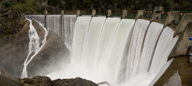
LG: Our water infrastructure was developed to address specific issues, piece by piece. No one was responsible for figuring out how to make the overall watershed work well for all the things we need it to do. Instead, we optimized the system in each location for one function—water supply, flood control and other tasks. It’s like having many people each design one part of a car without thinking of the whole vehicle—it doesn’t work very well.

This approach to managing freshwater ecosystems changed key natural processes that actually worked for us—we interrupted the flow of sediment down rivers, blocked salmon from migrating upstream, and drained wetlands. There is huge potential to redesign systems to let natural processes help us solve some of our complicated problems. For example, if we realigned a creek so that it could move sediment to the coast, it can help rebuild marshes that would protect the urban shoreline and bring a host of other benefits.

PPIC: What are the advantages of using natural infrastructure options?

LG: Bringing more benefits is the big one. Engineered solutions are mostly designed to bring just one benefit. Compared to a concrete flood basin, a marsh provides not just flood protection but also creates habitat for at-risk species, protects the shoreline, sequesters carbon, filters and breaks down contaminants, and creates recreational opportunities. And traditional engineered infrastructure has a lifespan. Over a 50-year lifespan, will it be flexible enough to adapt to climate change? Usually not. Engineered solutions also cost more over their lifetime to maintain and upgrade. In contrast, ecosystems are always changing; they can adapt in ways that engineered solutions can’t. Let’s restore these systems so they can continue to do useful work for us.

PPIC: How do we get there?

LG: We have a lot of knowledge of freshwater ecosystems, but knowing how to use them as part of our water infrastructure system is pretty new. So we need to test more, and build more. We’re doing it too slowly and at too small a scale.

We also need to work across jurisdictions. We haven’t set ourselves up socially to do this. Our current system has too many agencies with missions that aren’t well aligned. So we’ll need to voluntarily coordinate to make our watersheds work as they should—and provide incentives to bring agencies together over watershed planning. It will take time to make this change, and we’re very short on time. I think these big social challenges are harder to resolve than the science side.

Many people think of ecosystem restoration as something that is “nice to have,” not “have to have.” But growing extremes in fires, floods, and droughts are bringing people around to the realization that we’re dependent on ecosystems, and it matters if they’re healthy.  I hope that leads to the understanding that natural infrastructure is worth investing in and can perform better than traditional infrastructure in many cases. Climate change will require us to rebuild or fix a lot of our existing infrastructure. It’s a great opportunity to make transformational change.

Governor’s Budget Seeks to Build Water Resilience

Earlier this month the Newsom administration laid out its vision for addressing the linked issues of water and climate in two key policy documents: the much-anticipated draft of its Water Resilience Portfolio (WRP) and the governor’s budget proposal. The WRP, which resulted from an April 2019 executive order, was developed with extensive input from state agencies and stakeholders from around California. It outlines more than 100 actions designed to ensure that communities, the economy, and ecosystems across California’s diverse regions are able to weather our increasingly volatile climate. The January budget provides a roadmap of the administration’s initial spending priorities in this area.

The big ticket item is the $4.75 billion Climate Resilience Bond, which could appear on the November 2020 ballot. More than 60% of the bond amount would directly support actions in the WRP—including integrated regional water projects, safe drinking water, flood protection, and environmental stewardship. The remainder would address other climate resilience issues for California communities—including reducing risks from wildfire, sea level rise, and extreme heat—and closing the funding gap for restoration efforts in the troubled Salton Sea.

General obligation bonds—which are repaid through the state General Fund—have been a key tool for funding water and environment initiatives over the past two decades. Although they usually pass (eight of nine have been approved since 2000, totaling $39 billion in today’s dollars), voters rejected the most recent water bond—an $8.9 billion bond on the November 2018 ballot.

The administration also proposes a modest allocation of General Fund dollars to near-term actions on the portfolio’s long to-do list. Key areas of investment include:

  • Groundwater sustainability: Groundwater is an essential drought reserve. This year, local agencies and water users in the state’s most stressed basins will begin implementing the landmark Sustainable Groundwater Management Act to bring their basins into balance. The budget proposes to spend $60 million on the hard work of reducing water demand in ways that support local communities and economies, such as water trading and making the best use of fallowed cropland.
  • Better data for decision making: The WRP emphasizes the importance of modernizing data use to make the most of our water resources, and acknowledges the key role of the state as a data collector and developer. Of note is the proposed allocation of $80 million toward development of statewide LiDAR maps—landscape contour images that can help guide investments in habitat improvements and efforts to reduce risks from flooding and sea level rise.
  • Cutting “green tape”: The WRP also stresses the importance of improving the approval process for projects designed to enhance the natural environment, which is especially vulnerable to climate change. The current process, which involves many agencies, causes lengthy and costly delays. The budget proposes to reduce “green tape” by allocating $4 million for new staff positions to help make the approval process more efficient. Even modest additional resources, coupled with strong direction from state leadership to agency staff, could help California move toward truly coordinated, expedient, and effective stewardship of our natural environment.

The administration’s proposals provide much food for thought about state priorities in the California water arena. The WRP in particular emphasizes the state’s role in facilitating and supporting efforts at local and regional levels, where most water investments take place. In the coming months, there will no doubt be a lively debate about the specifics of the Climate Resilience Bond—which must be finalized by early summer to qualify for the ballot—as well as the other ways the Newsom administration and the legislature can help the state’s communities, economies, and environment build water resilience.

Providing Safe Drinking Water in the Face of Disasters: Lessons from Lake County

Climate change is already affecting water management across the state. Small rural communities with ongoing drinking water challenges are especially vulnerable to greater extremes brought on by a warming climate. We talked to Jan Coppinger, a special district administrator from Lake County, about how the county’s small water systems have dealt with an especially devastating string of natural disasters.

photo - Jan Coppinger

PPIC: Describe Lake County’s recent water challenges.

JAN COPPINGER: The county is predominantly rural, geographically diverse, and home to a number of small, disadvantaged communities and tribes. As towns in the county were developing, they built small, isolated water systems. We now have almost 100 public water systems, and some are barely getting by. The county tried to encourage consolidation of smaller systems into bigger ones in the late 1980s. Two major consolidations took place at that time: one that merged 41 small suppliers to create the North Lakeport water system—which today is one of our strongest, best water systems—and one that combined 15 systems. The county did feasibility studies on other potential consolidations, but these were met with opposition from local communities, so the issue was dropped altogether until recently.

Over the past several years, a string of natural disasters has kept Lake County in a constant state of emergency. It started with a drought, followed by two massive wildfires, which burned more than 60% of our county. The burn scars made the floods of 2017 and 2019 especially devastating. The 2015 Valley Fire destroyed thousands of homes and eight water systems. One small water supplier—Starview Water System—had 151 customers before the fire and only 14 afterward. Following these disasters, consolidation became a way to get some of the devastated water systems back up and running. We have had success with consolidating and rebuilding nine water systems in the Cobb Mountain area in the last couple of years.

PPIC: Consolidation is a big undertaking. What is the most important lesson from Lake County’s efforts?

JC: It’s a very complicated process, and in most cases, outside technical assistance is needed. We have two other areas now looking at consolidation, and we’re having a hard time identifying which of the small water agencies can take the lead in the process. The agencies are willing but they don’t have the managerial or technical capacity.  We have gotten support from the State Water Board and non-profit partners like the Rural Community Assistance Corporation (RCAC) to walk them through it. Financial assistance is another barrier, because consolidation can be expensive. The costs really vary. For the Cobb Mountain project, the feasibility study alone cost $250,000. We’re probably talking around $21 million for the entire consolidation. In that case, we had to bring some of the small systems up to code, and repair significant damage from the fire.

PPIC: How can small systems best prepare for natural disasters and climate change?

JC: Building physical connections to other systems and sharing resources is critical. Small systems need a backup supply to handle disasters—and because sometimes even the backup burns, they may need a backup to the backup. For instance, in the aftermath of the Valley Fire, the county invested $1.7 million to rebuild the Starview Water System, and connect it to other small systems in the Cobb Mountain area. The floods in early 2019 took out the roads, the culverts, and the brand new water system we built.

I never dreamed that entire water systems would burn to the ground. When I describe what has happened to small water systems in our area from these disasters, it really opens people’s eyes. Educating the people running these small systems has helped change minds about consolidation, in Lake County and across the state.

Watch a video of Jan Coppinger and other panelists talk about providing safe drinking water in California

Reducing Flood Risk in the Central Valley

The Central Valley has some of the highest risk of flooding in the state, and that risk is growing as the climate changes. We talked to Tim Ramirez, a member of the Central Valley Flood Protection Board, about how this risk is being managed for current and future conditions.

photo - Tim Ramirez

PPIC: Talk about managing flood risk in the valley.

TIM RAMIREZ: The valley has always flooded, especially in spring when snow melts in the high Sierra. Before it was developed, the landscape was often an inland sea in the spring. Now that many more people live there, it’s harder to minimize risk. The flood management system in the valley was envisioned 150 years ago, and in a lot of ways it continues to work. But the climate is changing with more rain and less snow, requiring an update.

That’s where the Central Valley Flood Protection Plan comes in. The plan is meant to not only protect people but also to help restore river ecosystems. We need to give rivers more room to flood, which better protects people and creates floodplains for native fishes, including Chinook salmon. For example, the Sacramento Valley Chinook salmon fall run is the single most important commercial fishery off northern California and southern Oregon, and there’s been a lot of work to ensure the health of those populations. There’s been a big push to restore salmon populations on the San Joaquin River, too. Reconnecting rivers to their floodplains is key to restoring salmon and illustrates the multiple benefits we can get from one project.

Rivers in the San Joaquin Valley in particular need more room. The San Joaquin River and its main tributaries—the Merced, Tuolumne, and Stanislaus—flow through Fresno, Merced, Modesto, Oakdale, and other communities. Each has less than 10,000 cubic feet per second (CFS) peak flow capacity in their floodways. By comparison, the American River has expanded its floodway and can now safely release more than 100,000 CFS. The San Joaquin system is plumbed to store and meter out snowmelt. But almost all climate forecasts show more rain and less snow. The reservoirs and levees on the San Joaquin aren’t designed or operated for large rainfall events or the “pineapple express” floods (like the January 1997 floods) that come from rainfall on large snowpack.

PPIC: Talk about the flood plan.

TR: What’s unique about the valley is that the state—through our board—is responsible for operating and maintaining levees. The plan outlines what needs to be done to minimize flood risk and restore river ecosystems. The first plan was completed in 2012. We’re scoping now for the third update, due for adoption in 2022. The most important thing about this update is the acknowledgment that we need to modify the system for changing climate conditions.

When the next big flood happens we’ll have a lot more people living in harm’s way. The most immediate thing we can do is make better use of new forecasting tools and prepare to execute evacuation plans, so we can get people to high ground.

One of highest long-term priorities is to make investments where the San Joaquin River flows into the Delta near Stockton. A lot of improvements are happening on the Sacramento side of the system—for example, setting back levees to make more room for floods—but not as many on the San Joaquin side. The state needs to support local efforts on the ground and also flesh out the plan so we can start building multi-benefit projects on the San Joaquin side.

PPIC: What is one thing you hope to see accomplished in five years?

TR: That’s easy—create expanded flood capacity, including new floodplain habitat, on the San Joaquin side of the system. I also want the state to set new standards for how much bigger our floodways need to be to protect Central Valley communities, taking into account our changing climate.

Near term, we also need to fund the necessary operations and maintenance for the system we have now. It’s a universal problem that affects flood management and management of other water systems, forests, and the electric grid.

Watch Tim Ramirez and other panelists discuss protecting Californians from fire, floods, and drought at our November 2019 water conference.

Addressing Inequality in Flood Risk

More than 7 million Californians live in places that are at risk of flooding. But not every community is well prepared to recover from floods. A new study, headed by experts at the University of California, Irvine (UCI), is looking at how flooding affects social inequality in flood-prone parts of the state. We talked to project leads Richard Matthew and Brett Sanders about the issue.

PPIC: How can flooding affect social inequality?

RICHARD MATTHEW: Inequity typically grows with disasters. There is a whole range of ways hazards increase social inequity, and these impacts are expected to increase as flooding becomes more frequent and intense because of climate change. Low-income communities and people of color tend to have considerably less access to resources, such as insurance, to help them recover from floods. They often don’t have good access to emergency response information. Floods can affect their health, and impose various costs they weren’t expecting. They may lose their jobs and their affordable housing. They may have poor access to relief funds. At the end of the day, higher-income people usually end up in about same place they were before a disaster, but lower income people largely end up worse off. And these effects can last for years, and sometimes even bring permanent losses.

PPIC: Talk about how we evaluate local and state flood risk currently.

BRETT SANDERS: We basically rely on Federal Emergency Management Agency (FEMA) maps to evaluate flood risk across the state. We make a lot of decisions on the risk to property and people based on whether they live inside or outside of the high flood risk zones those maps show. FEMA maps are fairly cryptic about flood hazard, and they’re not designed to help the average person understand their exposure to floods or what the impacts might be. This approach does a poor job of preparing communities to be more resilient to flooding. What we know from work we’ve done in Southern California is that creating visualizations of flooding in partnership with those affected leads to much more useful information. And fine-resolution data makes a difference. By visualizing flooding at the scale of buildings and streets, we not only increase awareness about flooding, but we can minimize differences in perceptions about flooding. This sets the stage for productive conversations—finding out the issues communities care about and what can be done to minimize future flood impacts. It also presents an opportunity to bring climate science into flood planning. This “collaborative flood modeling” approach is entirely complementary to the FEMA insurance program.

maps - A Sample Visualization of Flood Hazards - Credit: Brett Sanders/UCI
A sample visualization of flood hazards. Credit: Brett Sanders/UCI

PPIC: What are some policy changes that could help California better safeguard those most at risk?

RM: In the short term, we especially need to bring collaborative flood modeling into the state’s climate assessment. Flood maps must be developed with the people who will be affected, so we can understand how flooding will affect people and identify the ways in which they are vulnerable. Our study will be a step in that direction. Longer term, we need fair and affordable ways to reduce flood vulnerability in much of California. That might mean inclusion in risk reduction planning, improved emergency communications, community-based access to resources for people affected by floods—and also policies to protect lower-income communities from the losses they disproportionately incur.

BS: California should have intuitive and actionable flood data available statewide. More graded information is needed for the different kinds of flood risks across the state—levees breaking, sea level rising, intense precipitation, and mudflows coming out of the mountains.

Video: Preparing California’s Water System for Climate Extremes

Climate change is stressing water management across California. This week the PPIC Water Policy Center hosted its annual half-day workshop in Sacramento to discuss how state and local leaders can help prepare California’s water system and ecosystems for greater climate volatility.

“California has the most variable year-to-year climate of any state in the lower 48,” said Ellen Hanak, director of the PPIC Water Policy Center. “This is expected to increase, with drier dries and wetter wets.” Water management of the future will “need to start managing our droughts for floods and our floods for droughts,” she added, because greater volatility will make it harder to manage multipurpose reservoirs for both floods and droughts at the same time. Flexible, multi-benefit approaches—and solutions that are aligned across agencies—are going to be increasingly important in tackling these complex challenges.

The first panel focused on managing fast- and slow-moving disasters—floods, fires, and droughts. Panelists discussed the impacts of the recent fires on communities and local water systems, and the types of tools and partnerships that can help minimize risks. Tim Ramirez of the Central Valley Flood Protection Board described the significant and increasing flood risk in the San Joaquin Valley and called for a flood bypass to protect the growing Stockton region. And Michael Thompson of Sonoma Water called for funding from the state to support the “collaborative infrastructure” that will enable agencies to work together more effectively.

A panel on safe drinking water summarized the current status of the problem and discussed how to best use the new Safe and Affordable Drinking Water Fund to ensure that the water delivery system works for everyone. “I think that in five years we want to see every child in California has safe drinking water in their home,” said Jonathan Nelson of the Community Water Center. “The way we do that will be through multiple strategies, but that’s the vision we want to work toward, and ideally, as quickly as we can.”

Darrin Polhemus of the State Water Board said small water systems pay more for their systems and supplies, have a lack of management and technical capacity, and are particularly hard hit by water contamination and shortages. He noted that “we have to change this whole paradigm” to help improve how small water systems operate.

The final panel brought key state officials to the stage to discuss the governor’s water resilience portfolio, now being developed to address the challenges of a more volatile climate. Wade Crowfoot, secretary of the California Natural Resources Agency, said a top priority is to make it easier to help the environment and get multiple benefits out of water projects. “Permitting wetlands restoration is the exact same process as permitting a strip mall,” he said. “So while we’re threatened by climate change and our ecosystem is under unprecedented threat, state government makes it really expensive and slow to get [such projects] done.” He said his agency is committed to cutting “green tape” that slows ecosystem restoration projects.

Sounding a particularly hopeful note, Karen Ross, secretary of the California Department of Food and Agriculture, said we have “an opportunity of a lifetime for farmers to step up and identify how they can be part of the solution to climate change.” She noted that farm practices can sequester carbon while also building resiliency to help farms weather droughts and floods.

We invite you to watch the videos from this event:

Are Californians Prepared for the Next Natural Disaster?

Today marks the 30th anniversary of the Loma Prieta earthquake that shook Northern California. There’s a high probability that California will experience another major earthquake in the next 30 years. Given this threat—not to mention wildfires and floods—how worried are Californians about future disasters?

When asked about the potential impact of a disaster, six in ten adults are either very (28%) or somewhat (32%) worried that a household member will experience injury or property damage, or that a disaster will result in a major disruption of their household routine, according to PPIC’s latest statewide survey

Residents in Los Angeles (33%) and the Inland Empire (32%) are the most likely to be very worried, although majorities across regions are at least somewhat worried. Californians earning under $80,000 a year (35%) are twice as likely as those earning $80,000 or more (13%) to say they are very worried. Across racial/ethnic groups, Latinos (46%) are much more likely than African Americans (32%), Asian Americans (21%), and whites (16%) to be very worried.

figure - Los Angeles and Inland Empire Residents Are the Most Worried about a Natural Disaster

Despite high levels of concern, only three in ten Californians (29%) say they are very knowledgeable about the steps they can take to prepare for a disaster, while slightly more than half (54%) claim to be somewhat knowledgeable. Knowledge of disaster preparedness is similar across regions.

Yet differences emerge across demographic groups, with higher-income Californians (37% $80,000 or more) and homeowners (36%) more likely than lower-earning residents (25% under $80,000) and renters (24%) to say they are very knowledgeable.

How prepared are Californians for a natural disaster? Residents are more likely to have a disaster supplies kit (61%) than a definite disaster plan (50%). The share of Californians who report having a supplies kit or a definite plan is slightly higher than in 2014.

Residents in Los Angeles are the most likely to report having a supplies kit (65%) or a definite plan (53%). Across racial/ethnic groups, Asian Americans are the most likely to report having a supplies kit (65%) and African Americans are the most likely to have a definite plan (64%). Californians age 18 to 34 are less likely than older residents to have a supplies kit or a definite plan.

With the ever-present threat of earthquakes, wildfires, and flooding, Californians have to be prepared for an array of natural disasters. Stay tuned to the PPIC Statewide Survey as we track residents’ perceptions on this issue.

Water Policy Priorities for a Changing California

How will climate change affect California water management, and what steps should the state take to prepare for these changes? The PPIC Water Policy Center was asked by the Newsom administration to submit formal comments outlining key water policy priorities for the state—and ways to integrate actions across state agencies to implement these priorities. Our recommendations will inform the administration’s preparation of a water resilience portfolio. We address two key areas where the state can play a leading role—modernizing the water grid and protecting freshwater ecosystems.

California’s “water grid”—the network of reservoirs, aquifers, rivers, and water conveyance and flood control infrastructure that connects much of the state—was built for a climate that no longer exists. Yet it is the most important asset the state has for addressing changing conditions, both statewide and within regions. A modernized water grid, coupled with more flexible management, can reduce the cost of future droughts, improve how we manage flood risk, and help protect freshwater ecosystems. The state has made important advances in assessing and improving its water supply infrastructure, but it still lacks a comprehensive program to address storage, conveyance, and operational challenges in the next few decades.

California’s freshwater ecosystems present special challenges. The state’s native biodiversity continues to decline, despite decades of effort to improve conditions. Problems encountered during the 2012−16 drought—high water temperatures, low flows, insufficient cold water stored in reservoirs, and degraded habitat—will all likely worsen as droughts become more intense. Management of cold-water-dependent species—including salmon, trout, and some resident fishes such as Delta smelt—will continue to pose a significant challenge for water managers and regulators as conditions warm. Changing habitat conditions could make it impossible for some species to remain viable in their historic locations. And conflicts between the need to protect native species and land and water management activities are likely to increase. Here, too, some promising actions have been taken, but more needs to be done to prepare for coming changes.

Tackling these complex challenges with an integrated water resilience portfolio is a bold step, and one that has the potential to make California a leader in climate adaptation. You can read our recommendations to the administration here.

The Russian River: Managing at the Watershed Level

This is part of a series on issues facing California’s rivers.

Water managers across the state face new and more extreme challenges as the climate warms—from balancing the sometimes conflicting needs of urban, agricultural, and environmental water users to reducing risks from fires, floods, and droughts. We talked to Grant Davis, general manager of the Sonoma County Water Agency, about how his agency is approaching these challenges comprehensively, at the scale of the entire watershed.

photo - Grant Davis

PPIC: In your experience, what does it mean to manage at the watershed level?

Grant Davis: At its core, managing the Russian River watershed requires careful consideration of different land uses, stakeholders, water demands, environmental regulations, and ecosystem needs. We have to balance the competing needs of our 600,000 customers, a number of endangered species, recreational users, and a thriving farm community. In practice, we’ve changed our management considerably over the years. For example, we now intentionally release water from our two major reservoirs to improve estuary and fisheries management, while still meeting water supply needs.

In 2008, we began implementing what is known as a “biological opinion” designed to protect three endangered species—coho, Chinook and steelhead. An important element is restoring habitat on Dry Creek, a major tributary below our major drinking water reservoir. The idea is to slow water released from the reservoir to provide refuge for the fish. In the short run, it will likely make water deliveries harder, but it’s key to operating our system sustainably long term. When complete, we’ll have 6 miles of restored habitat out of a 14-mile stretch. It’s a multi-million-dollar effort—and a major undertaking in cooperation. Our agency has worked very closely with the regulating agencies and private landowners, who granted easements that enabled this restoration to occur.

PPIC: How do you use data sources to help you manage this watershed?

GD: We’re establishing information networks that bring multiple benefits. For example, we’re collaborating with the US Geological Survey on an integrated rainfall and stream gage network, which can help us evaluate whether storms might cause flash floods after fires. The rainfall data also helps with ecosystem management. In a changing climate, rainfall data is the primary input for understanding our watershed.

Since the Tubbs fire, we’ve begun working with more parties to leverage our respective data needs. For example, working with emergency responders, we’ve established a network of fire cameras that inform a text alert system. And working with PG&E, we’re looking at installing equipment to forecast atmospheric rivers and fire weather at the same weather stations.

It’s also critical that we use science to better understand atmospheric rivers, which will in turn allow us to better manage reservoirs as the climate warms. These large storms contribute to most flooding in California, and up to 95% of floods in our watershed. And the lack of atmospheric rivers leads to drought. We’re now working with the US Army Corps of Engineers, NOAA (the National Oceanic and Atmospheric Administration), the Scripps Institute of Oceanography, the Department of Water Resources, and other colleagues to study this phenomenon. Together, we’re developing a joint project that uses improved forecasting of atmospheric rivers to better manage water releases from reservoirs. We’ve built a coalition with other water agencies—including those in Orange County, Turlock, and Yuba—that are interested in exploring these same issues in their rivers. Data from the project will help us improve how we manage water supply, floods, and the environment.

PPIC: Talk about how the interaction between surface water and groundwater has affected Russian River water management.

GD: Our watershed is ground zero for efforts to understand the links between groundwater and surface water, and to better manage both together. In 2014, Mark West Creek was selected as one of five priority creeks as part of the California Water Action Plan. The creek goes through a depleted groundwater basin, which has affected its flows. The Department of Fish and Wildlife is now developing recommended flow levels to protect and restore the creek’s critical habitat. The project will also quantify human needs within the watershed.

In places like Mark West Creek, groundwater recharge can play a critical role in addressing the “timing divide” for maintaining freshwater fisheries—because the question is not always whether water is available, but when it’s available. A pilot project in the town of Sonoma will use Russian River surface water in wet winters to recharge the aquifer. We can then pump it when it’s needed in dry summer months for critical uses.

Thanks to Jay Jasperse and Carlos Diaz, both of the Sonoma County Water Agency, for their contributions to this article.

Preparing California’s Rivers for a Changing Climate

This is part of a series on issues facing California’s rivers.

California’s rivers and streams have experienced enormous changes over the past 150 years, and a warming climate brings new challenges. We talked to Ted Grantham—a river scientist at UC Berkeley and a member of the PPIC Water Policy Center research network—about the state of the state’s rivers. Grantham was recently appointed as the first PPIC CalTrout Ecosystem Fellow. Thanks to the donors that helped us launch this program: Gary Arabian, the Morgan Family Foundation, Nick Graves, John Osterweis, and the Rosenberg Ach Foundation.

photo - Ted Grantham

PPIC: Talk about the changes affecting California’s rivers and streams.

Ted Grantham: California’s rivers and streams have experienced so much change since European settlement that they’re considered “novel ecosystems.” Gold mining and logging brought a massive amount of sediment into rivers. Riparian forests that lined Central Valley rivers and extensive wetlands on the valley floor have mostly been converted to farming. Non-native species have been introduced to most of California’s rivers, lakes, and estuaries, which prey upon or compete with native species. Urban rivers across the state have been channelized. And essentially every major river and stream in the state is impacted by a dam. Dams aren’t just barriers to migratory fish, they also alter downstream flows.

We’ve also prevented rivers from being able to move. Rivers are not static features; when given the opportunity, they will dynamically respond to changes in climate. This dynamism is inherent to how rivers work—it’s how habitat is created and maintained for many species. And it’s what makes these systems resilient over time.

Given all these fundamental changes, it’s remarkable that most of the state’s native fish species are still with us, although many are at risk of extinction.

PPIC: How are the state’s rivers expected to respond to climate change?

TG: The most direct change is increasing temperatures. Our rivers and streams will continue to heat up in a warming climate. Even if average precipitation stays the same, we’ll also experience more extremes, with both drought years and wet years more likely to occur. While increasing floods pose risks to some river ecosystems, it’s drought we’re most concerned about. Drought not only reduces the amount of water available for the environment, it also intensifies competition with other water users, making it harder to protect freshwater ecosystems.

Climate change is particularly problematic for cold-water fish such as salmon. In the short term, large dams have the potential to limit warming to some degree because they hold reserves of cold water. For example, Shasta Dam is managed to sustain salmon populations downstream through cold-water releases. But if water gets too warm over time, our ability to sustain cold-water reserves in the reservoir will decline. In the long term, redesigning dams to allow for fish passage or strategically removing dams will give salmon access to cold water in higher elevation streams.

PPIC: How can we prepare rivers for a changing climate?

TG: There are several promising management strategies that are gaining traction and could help build climate resilience in our rivers. Two important ones are securing environmental flows and restoring floodplains.

“Environmental flows” refers to the quantity, quality, and timing of water needed to maintain healthy rivers and ecosystem services that people rely on. In the past, little consideration was given to water needs of the environment. But that is changing and we’re seeing a growing effort to establish legally protected water allocations for environmental benefits. For example, I’m currently involved in the California Environmental Flows Framework, a program to support the development of environmental flow standards in rivers and streams throughout the state.

We’re also seeing more interest in multi-benefit approaches to floodplain management. Most of California’s rivers are disconnected from their floodplains, which have been converted to agriculture and urban uses. This has had huge impacts on fish populations and other species. As the likelihood of extreme floods increases with climate change, reconnecting floodplains is a cost-effective way to reduce flood risk. What’s exciting is that floodplain restoration can be compatible with agriculture and can also provide productive habitats. For example, the Yolo Bypass is primarily managed to protect Sacramento from flooding, but it also supports seasonal agriculture and habitat for birds and fish. Bringing water back to our floodplains can even help replenish groundwater, which is a critical water source in drought years.