Are Californians Prepared for the Next Natural Disaster?

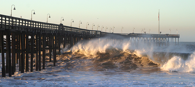
Today marks the 30th anniversary of the Loma Prieta earthquake that shook Northern California. There’s a high probability that California will experience another major earthquake in the next 30 years. Given this threat—not to mention wildfires and floods—how worried are Californians about future disasters?

When asked about the potential impact of a disaster, six in ten adults are either very (28%) or somewhat (32%) worried that a household member will experience injury or property damage, or that a disaster will result in a major disruption of their household routine, according to PPIC’s latest statewide survey

Residents in Los Angeles (33%) and the Inland Empire (32%) are the most likely to be very worried, although majorities across regions are at least somewhat worried. Californians earning under $80,000 a year (35%) are twice as likely as those earning $80,000 or more (13%) to say they are very worried. Across racial/ethnic groups, Latinos (46%) are much more likely than African Americans (32%), Asian Americans (21%), and whites (16%) to be very worried.

figure - Los Angeles and Inland Empire Residents Are the Most Worried about a Natural Disaster

Despite high levels of concern, only three in ten Californians (29%) say they are very knowledgeable about the steps they can take to prepare for a disaster, while slightly more than half (54%) claim to be somewhat knowledgeable. Knowledge of disaster preparedness is similar across regions.

Yet differences emerge across demographic groups, with higher-income Californians (37% $80,000 or more) and homeowners (36%) more likely than lower-earning residents (25% under $80,000) and renters (24%) to say they are very knowledgeable.

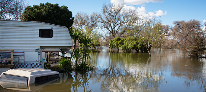
How prepared are Californians for a natural disaster? Residents are more likely to have a disaster supplies kit (61%) than a definite disaster plan (50%). The share of Californians who report having a supplies kit or a definite plan is slightly higher than in 2014.

Residents in Los Angeles are the most likely to report having a supplies kit (65%) or a definite plan (53%). Across racial/ethnic groups, Asian Americans are the most likely to report having a supplies kit (65%) and African Americans are the most likely to have a definite plan (64%). Californians age 18 to 34 are less likely than older residents to have a supplies kit or a definite plan.

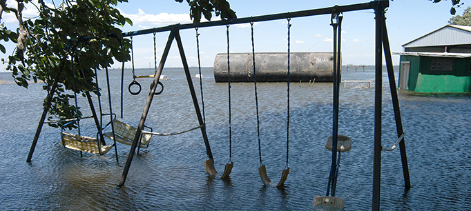
With the ever-present threat of earthquakes, wildfires, and flooding, Californians have to be prepared for an array of natural disasters. Stay tuned to the PPIC Statewide Survey as we track residents’ perceptions on this issue.

Video: Californians and Their Government

As California’s 2020 Democratic presidential primary draws closer, Elizabeth Warren, Joe Biden, and Bernie Sanders lead the rest of the field by a wide margin. However, many voters say they would consider supporting a candidate other than their current choice. These and other key findings from PPIC’s latest statewide survey were outlined by Rachel Lawler in Sacramento last Thursday.

Likely voters identifying as registered Democrats or as Democratic-leaning independents support Elizabeth Warren (23%), Joe Biden (22%), and Bernie Sanders (21%) at levels well above Kamala Harris (8%) and Pete Buttigieg (6%). No other candidate is preferred by more than 3 percent, and 9 percent say they don’t know which candidate they prefer. More than half of voters who expressed a preference would consider supporting another candidate.

The survey asked about a $15 billion bond for school and college construction that has been approved by the legislature for the March 2020 ballot. It has the support of two in three adults—but only 54 percent of likely voters. This narrow margin of support coincides with concern about the state’s economic outlook. Fewer than half (41% adults, 37% likely voters) expect good times financially in California during the next 12 months.

A potential November 2020 ballot measure that would amend Proposition 13 to tax commercial properties at their current market rate and direct some of the new revenue to K–12 public schools is favored by 57 percent of adults. However, fewer than half (47%) of likely voters favor the measure, and this share is down somewhat from April 2019 (54%). A potential state bond measure to fund water infrastructure is favored by 68 percent of adults and 57 percent of likely voters.

Other survey highlights:

  • Californians are most likely to name homelessness (15% adults, 16% likely voters) and jobs and the economy (15% adults, 13% likely voters) as the top issue facing the state. Other issues named include housing costs, immigration, and the environment.
  • Most Californians view immigrants as a benefit to the state, and half are at least somewhat worried about someone they know being deported as a result of increased federal immigration enforcement.
  • Two in three Californians think the Supreme Court should not overturn Roe v. Wade; more than half think some states are making it too difficult to get an abortion.
  • Half of Californians say they have a disaster plan and six in ten have a disaster supplies kit. Six in ten are very (28%) or somewhat (32%) worried about personal injury, property damage, or a major disruption of their routine as the result of a disaster.


How Climate Change Drives Disaster Cascades

California has had a devastating series of natural disasters recent years, prompting questions about the role of climate change in worsening fires, droughts, and floods. We talked to Amir AghaKouchak—an associate professor of civil and environmental engineering at UC Irvine―about how a warming climate is affecting natural hazards.

PPIC: Can you talk about how climate change is causing chains of extreme events?

Amir AghaKouchak: Climate warming can compound hazardous events. For example, this sequence of events led to devastating compound impacts in California: (1) severe drought in 2012‒16 weakened or killed many trees and vegetation; (2) record winter precipitation in 2017 caused epic growth of fine fuels like grass; (3) a warm, dry spring and summer dried out vegetation, leading to record-low moisture levels in this vegetation, (4) Diablo winds in Northern California and Santa Ana winds in Southern California set records for low humidity and sustained wind velocities; (5) record-setting fires occurred (e.g., the Thomas Fire in December 2017); and  (6) intense rainfall near Santa Barbara in January 2018 created the most deadly debris flows in history.

Cascading events are a special form of compound events. Sometimes the drivers involved in a cascading event are physically independent (e.g., a wildfire in summer and a rainfall event that winter), but they are linked through their impacts. The Thomas fire in Southern California didn’t cause the related mudslide. But the order of these events—they were about a month apart—had an extreme impact. Models show that a warming climate will bring more wildfires to California, which means a higher chance of future mudslides and debris flows.

We know, for example, that drought and heat waves are connected. It’s widely acknowledged that California’s climate is warming. But what’s striking is that our droughts appear to be warming much faster than the overall average. Heat waves often have atmospheric origins, but they can also be worsened by dry conditions. The way soil cools down is similar to what our bodies do—we sweat and are cooled by its evaporation. The land’s surface cools the same way. But when there’s little or no moisture for evaporation, the sun’s radiation warms the surface and intensifies heat waves. A hotter future will bring drier soil, which can lead to more intense heat waves.

PPIC: What can be done to better manage future extreme events?

AA: Historically, we have usually ignored the relationships among the variables used to assess risk. For example, US Geological Survey guidelines for flood risks in coastal areas do not consider the dynamics of the oceans. Sea level rise brings a greater chance of flooding in coastal areas due to higher tide and surge baselines. We need to develop methods that allow us to do more comprehensive risk analysis for floods, wildfires, mudslides, etc. On the science side, we need better methods to analyze the risks of related events. More public education and outreach about these types of events are also very important. Moderate rainfall may not worry you, but if it’s after a wildfire it could lead to extreme risks. We need to make sure people understand that moderate events can potentially lead to an extreme disaster cascade.

PPIC: What are some changes we should start making now to boost resilience for these “disaster cascades”?

AA: Policy change isn’t easy. But California is very progressive and has even formed a committee, which I’m a member of, to assess how climate change information can be used for improving engineering design and management of infrastructure. Our report identifies gaps and challenges, and offers nine major recommendations for making the state’s infrastructure “climate safe.” For example, we call for updating design and maintenance codes to enhance resilience. We also recommend funding collaborative efforts between state infrastructure agencies and climate scientists to develop tools for improving resilience.

Addressing these gaps won’t be easy. The good news is that the working group has had representation from all the major state agencies―including the Department of Water Resources, Caltrans, and the California Energy Commission. The agencies are interested in working together to improve resilience down the road. This is a very promising sign for the future.

Could Wildfires Affect the 2020 Census?

The decennial census plays an essential role in American democracy. The stakes are huge for California, and 2020 is fast approaching. This series of blog posts takes a detailed look at California communities that may be at risk of being undercounted.

Wildfires in California have burned millions of acres and destroyed or threatened thousands of homes, displacing families around the state. Among their many devastating long-term effects, disasters may elevate the risk of undercounting some communities in the upcoming census.

The Census Bureau’s goal is to “count everyone, only once, and in the right place.” In practice, this means that people are counted where they reside as of “Census Day” (April 1, 2020), even if this is not their permanent residence. Given that Californians who lose their homes in disasters must then find housing in a notoriously difficult market, housing conditions alone could pose a hurdle to accurately counting communities that have been displaced by wildfires.

Hurricane Katrina presented similar issues for the 2010 Census. While some people displaced from the Gulf Coast moved away permanently, many others were counted in counties or states they intended to leave once their homes were again habitable. Still others stayed in accommodations closer to home, which—depending on resources—were sometimes shared, non-standard, or even not yet considered habitable. These families proved difficult to reach by mail, with just 45% of New Orleans households returning forms at first (compared with 61% in 2000). On-the-ground staff were ultimately responsible for hand-delivering questionnaires to the majority of New Orleans homes. Even though the Census Bureau can request a funding contingency for such costly efforts, it will have many competing demands for resources in 2020.

In the aftermath of California’s recent fires, local areas face unique challenges to getting an accurate census count—particularly in terms of housing. Here we look at three of those areas across the state. Current estimates show that 20,000 residents were affected by the Carr fire (Redding, 2018) and that the Thomas fire (Ventura County, 2017) and the Tubbs fire (Santa Rosa, 2017) each affected about 40,000 residents. Before the fires, none of these areas stood out in terms of having large populations of hard-to-count residents, but the loss of housing could create new obstacles.

Even in normal times, housing plays a key role in getting an accurate census count. Rental units and mobile homes are less likely to appear on official census address lists. Moreover, their residents tend to move more often, making them hard to reach. Wildfire displacement heightens these challenges, especially in places where housing was already hard to count. For example, mobile homes made up 6% of housing in the Thomas fire area—double the statewide average. In the Carr fire area, they constituted 10%.

Before the fires, the share of renters in all three fire areas was lower than the statewide share, but the loss of homes likely changed this picture. CalFire reports that the Thomas fire destroyed 775 homes—and subsequent mudslides in the area demolished at least another 100. The Carr fire destroyed 1,079 homes, and the Tubbs fire razed 3,000. Displaced residents are more likely to rent, reside in non-standard arrangements, and/or struggle with poverty, creating new challenges for the census count.

Blog figure: Housing conditions in fire zones varied widely

In 2020, given the likelihood that families will continue to be displaced by wildfires or other natural disasters, it will be important for state and local leaders to coordinate with the Census Bureau to ensure that all Californians are counted accurately—regardless of their housing situation. For more on areas with hard-to-count housing and other challenges, visit PPIC’s interactive census maps.

Hurricanes Are Getting Worse. California Should Take Note

As Hurricane Florence ground its way through the Carolinas this past weekend, climate watchers couldn’t help but notice that the size and behavior of the storm have been eerily reminiscent of Hurricane Harvey, which devastated Houston last year. What made these two hurricanes so destructive was their slow pace and the fact that they were supercharged with moisture from bathtub-warm oceans. It’s a deadly combination that leads to epic, record-setting amounts of rainfall and unprecedented flooding, amplifying damage from the high winds and storm surge typically associated with hurricanes.

Once Florence leaves the Carolinas and the floods have receded, the nation will rally to clean up what will likely be of one of its top five most destructive hurricanes. Florence will add to this century’s staggering storm damage, caused by 22 hurricanes or tropical storms that led to more than $700 billion in damages in the United States (adjusted for inflation).

Is this part of a trend? Most certainly. The National Oceanic and Atmospheric Administration has a detailed analysis of billion-dollar US weather disasters since 1980. Clearly, weather impacts are getting much more expensive—and much more frequent.

What does this mean for California? First, like all other states in the nation, California relies upon the federal government to help with disaster preparedness, response, and recovery. The increase in the number of natural disasters and their growing costs affect the ability of federal agencies to respond. And the most important tool in mitigating flood risk—flood insurance—relies on an insolvent National Flood Insurance Program that will surely be hit hard by Florence.

Second, while it is tempting for Californians to write off Florence as a weather problem that affects the Gulf Coast and Atlantic states, this would be a mistake. We have our own hurricane-equivalents here, called atmospheric rivers. These can produce rainfall rates similar to those found in hurricanes, and they are responsible for most of our floods.

California is no stranger to extreme floods that rival hurricanes in terms of damages. The Great Flood of 1861‒62 affected the entire state and turned the Central Valley into a lake. If that same flood were to happen today, studies by the US Geological Survey suggest that more than $700 billion in damages would occur (equal to all the damages from all hurricanes nationwide in the past 18 years) and more than 1.5 million Californians would be displaced. Research by Daniel Swain, a climate scientist at UCLA, suggests that the risk of this scale of flooding is increasing as global warming intensifies. Indeed, his work has shown that the probability of a flood similar to the 1861‒62 flood occurring in California by mid-century is greater­ than the probability that it won’t.

Florence is a sobering hurricane that will likely be one of the worst in history. California would do well to heed some of its key lessons. As discussed in our recent report and highlighted by California’s Fourth Climate Assessment, flood risk is increasing due to climate warming. The 2017 crisis at Oroville Dam is an expensive reminder that California needs to upgrade its aging water management infrastructure. This will require finding new and innovative ways to fund flood management improvements.

California should also expand its efforts to steer new development away from high flood-risk areas through better land-use planning that incorporates increasing risk.

No matter how well California prepares, there will always be floods that overwhelm defenses, damage homes and businesses, and threaten lives. The state needs to continue to improve emergency preparations for floods and to encourage those who live in areas at risk of flooding to purchase insurance.

California has been a leader in reducing its contribution of greenhouse gases. But more work is needed to ensure its water supply and flood management systems are able to withstand a more volatile climate. California must act now to weather floods of the future.

Flood Prevention 101: Stay Out of the Floodplain

What did the catastrophic hurricane season of 2017 tell us about how we’re managing flood risk? We talked to Nicholas Pinter—a flood and floodplains expert at the UC Davis Center for Watershed Sciences and a member of the PPIC Water Policy Center research network―about improving flood management.

PPIC: Why did Hurricane Harvey result in so much damage to Houston?

Nicholas Pinter: Houston has had very bad land use planning—it is built on flood-prone land, and its inadequate storm drainage makes flooding worse. Combine these glaring flood-management flaws with the unprecedented rainfall that Harvey brought and you’ve got a truly epic flood disaster. Harvey’s damage is clearly a product of both human choices and the storm’s intensity.

The number and magnitude of recent extreme storms are consistent with predictions for a changing climate. There’s a nagging feeling among some of us who study flood disasters that maybe we’ve reached a sort of tipping point, with short-duration storms dumping unprecedented rainfalls.  Harvey may be an example of this.  And if it is happening, our window of opportunity to improve flood systems may be shrinking.

PPIC: What are your top priorities for reducing flood risk?

NP: One thing that scientists, floodplain managers, and many politicians agree on is that we must limit floodplain development. A lot of the damage from Harvey was supposed to be prevented by the National Flood Insurance Program (NFIP). But the program failed in Houston in large part due to the failure of its primary goal—to discourage development in floodplains.

With the enactment of the NFIP in 1968, the US government agreed to provide subsidized flood insurance in exchange for local controls on building in floodplains. Communities that prohibit development on their floodplains can get underwritten insurance through the program (private flood insurance options are very limited).

But enforcement of the NFIP’s floodplain rule is very mixed across the US. A good example is Illinois. For the past 25 years, that state has aggressively enforced floodplain regulations and limitations. On other end of spectrum is Texas, where they embraced development and seemed to see floodplain limitations as job killers. Differences in enforcement explain many of the documented differences in flood damages and flood resilience.

PPIC: How are we doing on flood management in California?

NP: California is doing a lot of things right, and is learning from its past mistakes. A lot of money has been invested in improving levees. California is enforcing NFIP standards and trying to limit new construction on its floodplains (though with exceptions). But the Oroville crisis was a big wake-up call. If the emergency spillway had failed—and we were within hours of it—Oroville could have been a lethal disaster similar to Katrina. All eyes are now on aging dams as well as levees.

One issue I’d like to see improvement on is flood insurance. While many other states are net recipients of NFIP, California receives something like 14 cents on every dollar it pays in premiums to the program.  This appears to reflect California’s more rigorous effort to limit flood damage in its floodplains.

FEMA (the Federal Emergency Management Agency) recognizes wide differences in NFIP enforcement nationwide and has proposed a national disaster deductible to push back on states with poor enforcement and benefit those doing a good job. A second option being considered is a state-by-state rating system. And yet another option is for California to create its own flood insurance vehicle.

PPIC: Is there an argument for learning to live with flooding and rebuild after disaster strikes?

NP: A century ago the strategy was largely to live with floods. People clustered near rivers and had a tolerance for getting their feet wet occasionally. Fast forward to current times: a big leap in the density and value of infrastructure has greatly diminished that tolerance.

It’s very easy to creep forward gradually onto floodplains and much harder to back away from the flood hazard this brings. So the first and most valuable lesson is to stop creeping forward and strictly limit new floodplain development.  In some cases, opportunities exist to set back levees and reconnect rivers to their floodplains. These kinds of efforts often can provide valuable, multi-layered benefits.

What Recent Hurricanes Mean for Flood Insurance in California

Three exceptional hurricanes—Harvey, Irma, and Maria— caused staggering damages from floods, winds, and storm surge in recent weeks. It’s likely they will make the record books as the most costly natural disasters in US history.

Although California doesn’t get hurricanes, it does get large storms (called “atmospheric rivers”) that can be just as damaging to people and property. Currently, one in five Californians and close to $600 billion worth of structures are vulnerable to flooding.

One way for residents and businesses to reduce the financial risks of flooding is to carry insurance. Millions of Californians depend on the National Flood Insurance Program (NFIP), managed by the Federal Emergency Management Agency (FEMA). But at almost 50 years old—and facing an uncertain reauthorization this December—it has many problems.

The most immediate concern is the imbalance between premiums and claims. Currently, the NFIP is more than $25 billion in debt―a figure that will certainly grow once all the recent hurricane claims are processed.

“The program never charged prices that would cover a year like Hurricane Katrina, where it paid out more than it had over the life of the program.  And the string of storms since then—Ike, Sandy, and now Harvey, Irma, and Maria—have only worsened its debt,” says Carolyn Kousky, director of policy research for the Wharton Risk Center and a member of the PPIC Water Policy Center research network.  “Realistically, the program will not be able to repay this debt, so the best thing may be for Congress to simply forgive it, while also putting in place a new approach to pay for catastrophic events.”

Another problem is that too many people at risk of flooding do not enroll in the program. In Houston, approximately 80% of Harvey-flooded homes were not insured.  And here in California, just 10% of flood-prone Sacramento county households and only half of those in high-risk areas have flood insurance.  Among the reasons so few people purchase insurance, Kousky says, are “unwillingness or inability to pay, a misunderstanding about the role of insurance, an unsubstantiated faith in disaster aid, and importantly, no information or even misinformation on flood risks.”

Inadequate perception of risk stems, in part, from the way FEMA maps flood hazards and mandates insurance. Currently, FEMA requires (but does not sufficiently enforce) flood insurance for homes with a 1-in-100 chance of flooding in any given year (the so-called 100-year flood). For homes in the floodplain but out of this high-risk zone, insurance is optional.

Nicholas Pinter—the associate director of the UC Davis Center for Watershed Sciences and a member of the PPIC Water Policy Center research network―notes that this gives a false impression that those outside this zone are safer than those within it. His laboratory found that roughly half the flooding from Harvey was outside of Houston’s 100-year floodplain zone.

“The picture in California is much better than in Texas,” Pinter says. “But updating flood maps here still takes many years, and California still largely works within FEMA’s framework of the ‘all or nothing’ 100-year floodplain.”

But the state may not be getting a good deal from the NFIP.  According to Pinter, California pays much more into the program than it is getting back.  He notes that California has gotten just 14 cents in return for every dollar of premiums paid.  The Central Valley—the most flood vulnerable area of the state—got just 9 cents per dollar.

“For a variety of reasons, California may be overpaying for its actual flood risk,” Pinter suggests. “The state needs to explore whether it is cheaper to develop its own flood insurance program and to invest the savings—estimated to be at least $150 million per year—in reducing flood risk across California.”

With this year’s unprecedented string of flood disasters and uncertainty for national insurance, it’s time for real policy reforms to ensure Californians are prepared to weather the growing risk of floods. Fixing our flood insurance problems is one way to start.

Learn more
Read Floods in California (PPIC fact sheet, September 2017)
Watch our 3-minute video “Floods”
Read Financing Flood Losses by Carolyn Kousky (February 2017), and her related blog post, “Flooding and the Economics of Risk Reduction” (August 30, 2017)

Acting Locally to Address Sea Level Rise


The author is a member of the PPIC Water Policy Center research network.

October brought a preview of some of the climate risks that coastal regions face. Hurricane Matthew wreaked havoc from Haiti to the eastern seaboard and the West Coast’s first “atmospheric river” storm brought flood warnings in some areas. The risk of coastal flooding is growing as a warming climate causes more intense precipitation and a gradual rise in sea level from Earth’s melting ice sheets. Both worsen the effect of high tides and large storms.

We have a few decades and perhaps up to a century to adjust to sea levels that are at least three feet higher than they are today. Coastal communities can expect a host of costly and dangerous problems from storms, including flooded wastewater treatment plants, shoreline erosion, industrial facilities spilling chemicals into waterways, and water supply systems inundated by seawater. The effects of floods are projected to be the most costly part of climate change. Some estimates put the global losses at $1 trillion a year by 2050, or roughly two percent of global GDP.

Although seas are rising relatively slowly, change will not be gradual at the community level. A series of strong winter storms that combine high tides, large waves, and intense rainfall can radically reshape a community in a matter of days.

For California to adapt, every coastal community will need a plan that envisions a future with higher sea levels and greater risk of coastal erosion and flooding. The plans will need to outline specific projects needed to weather changing conditions over coming decades. Communities will need to figure out how to raise roads, buildings, and critical infrastructure, and ways to enhance natural protective systems, such as beaches. Some combination of building codes and assistance programs is likely to be necessary. So far, most California communities are in the early stages of planning to adapt to rising seas.

Research shows that increasing awareness and knowledge of hazards is not enough to head off losses from disaster. A complicating factor in adaptation planning is how to make the scientific information actionable at the local level.

One new approach shows promise. A UC Irvine program called FloodRISE is bringing together experts in flood disasters, engineering, and the social sciences with local experts and community members in a number of Southern California communities and Tijuana, Mexico. As part of that program, we’re working with decision makers, community groups, NGOs, and personnel from key departments such as public works, city planning, emergency management, and environmental resources. The teams work together to create advanced visualizations of flooding. Using the latest climate science and data, local knowledge and flood modeling technology, they focus on addressing specific issues that communities care about the most.

How well we manage the problem of rising seas will to some degree depend on funding choices we make now. My FloodRISE collaborator Richard Matthew, a political scientist and disaster expert at UCI’s Blum Center for Poverty Alleviation, notes that funding for planning and preventing disaster risks is dwarfed by the resources that pour into communities after disaster strikes. In the chaos of emergency management, decisions must be made quickly and with very limited information, which too often leads to wasteful spending. Allocating more funds to climate-risk planning efforts would not only help local communities prepare for a rising sea and coastal flooding—it could help reduce wasteful spending later.

Learn more

Read California’s Water: Preparing for Floods (from California’s Water briefing kit, October 2016)
Read “Floods in California” (PPIC Water Policy Center fact sheet, February 2016)
Visit the PPIC Water Policy Center’s floods resource page

Flood Insurance: Why Don’t People Buy It?

The author is a member of the PPIC Water Policy Center research network.

Flood damage has been increasing in the US, largely due to where we build. Climate scientists are concerned that as the climate warms, there will be more intense downpours, stronger hurricanes, and rising seas, all of which could increase flood risk. Despite this, people have been dropping flood insurance nationwide. The number of policies from the National Flood Insurance Program (NFIP)—the main provider of flood coverage in the US—has been falling since 2011, perhaps due to changes in pricing. But Californians have recently bucked the trend. The Federal Emergency Management Agency (FEMA) reports that flood insurance sales in the state are up 12 percent this winter (compared to 3 percent last fall) as residents prepared for possible El Niño flooding.

This increase in California is all the more notable since, generally speaking, most people don’t voluntarily buy disaster insurance. Low demand for flood insurance led Congress, early in the history of the NFIP, to make purchase mandatory for homes located in a FEMA-mapped 100-year floodplain that had a mortgage from a federally backed or regulated lender. Yet just half of these homes are insured, with more in coastal areas. Outside the 100-year floodplain, even where there is flood risk, few homes are insured.

This can have ripple effects in flood-prone communities. Insurance protects families against the financial impacts of substantial flood damage. Insured properties were 37 percent more likely to have been rebuilt after Hurricane Katrina. And when people rebuild, economies can come back to life. Len Shabman and I found that post-disaster aid to households is usually quite limited, making insurance the main tool for households unable to cover rebuilding expenses.

So why don’t more people buy disaster insurance? People may think floods won’t happen to them. Insurance may be too expensive, or they may believe it isn’t worth it. They may be uninformed about flood risks. People seem to insure when recent events raise awareness about the risks. My recent research shows that a federal requirement for disaster-aid recipients to purchase flood coverage explains much of this increase.

For people living in a floodplain or behind a levee, flood coverage is important well beyond El Niño. Yet past experience suggests many newly insured Californians will not keep their policies after El Niño passes. Many NFIP policies are dropped in a few years; only a third of policies are held for six years or longer. Although some of this can be explained by people moving, fading concern about floods is likely also a factor. In 1998—a year after California’s last widespread flooding—flood insurance sales were at an all-time high of nearly half a million policies. Ten years later, that number had fallen by half.

Several policy changes could encourage more at-risk households to insure. Informing residents of the likelihood of flooding, potential damage, and the limitations of disaster aid can help them make better decisions. FEMA outreach at times of increased risk, such as El Niño events or after major wildfires, can help alert homeowners to times when coverage may be warranted. Finally, a recent report from the National Research Council addressed ways to help lower premiums when insurance is too costly for low- or middle-income families in risky locations.

Learn more

Read “California’s Water: Preparing for Floods” (from California’s Water briefing kit, April 2015)
Read “A Look at 35 Years of Flood Insurance Claims” (from Resources magazine, winter 2016)
Visit the PPIC Water Policy Center

State’s Ecosystems Face a Flood of Changes

With El Niño making an impressive new year’s debut, talk of drought has turned to worries about floods. How will the state’s drought-starved ecosystems adapt to the taps being turned on again? We talked with Joshua Viers, an ecological engineer at UC Merced and a member of the PPIC Water Policy Center research network, about California ecosystems’ response to flooding.

PPIC: Are floods “natural disasters” for nature?

Josh Viers: Disturbances like floods, droughts, and fire are regular features in California, and our ecosystems are fairly well adapted to these extreme events. There has been a lot of evolutionary adaptation to these disturbances over time, and this is one reason California has such high biodiversity. What compromises our ecosystems’ ability to be resilient to extreme events is that many habitats and species populations have been degraded by human activities. That makes it harder to gauge an ecosystem’s ability to snap back after extreme drought or floods.

Flooding can be quite good for aquatic ecosystems, especially after years of drought, because it reorganizes the physical habitat by moving rocks, logs, and sediments. If water overflows into the floodplain, it can recharge shallow groundwater, replenish soil nutrients, distribute seeds from native plants, and create new habitat for animals and plants.

PPIC: How does California’s flood-control infrastructure affect the ability to manage water for the environment?

JV: California has one of the most elaborate water infrastructure systems in the world. Over the decades, it has had both positive and negative effects on our ecosystems. Our system of dams and canals has degraded habitat, and severely altered the natural variability of river flows, which can disrupt ecosystem functioning and species’ life cycles. But we’re increasingly able to manage the system to mimic rivers’ natural flows and improve long-term ecosystem functioning. As the climate warms, however, we will need to manage water flows to ensure downstream water temperatures don’t get too high for many of our native fish species.

PPIC: What changes to our flood management system could improve environmental conditions?

JV: We need better forecasting on the amount of water coming into reservoirs, so we can minimize the impacts of sudden high releases from dams, which can damage ecosystems downstream. Being able to “pre-wet” ecosystems dried from the drought can help reduce the effects of a sharp change. For example, in fall the Cosumnes River had many native fish waiting to swim upstream to spawn, but its dry channel forced them to wait longer than normal. The first rains just saturate the streambed. Pre-wetting it allows these rains to become streamflow and help get those fish moving upstream on time.

A longer term fix would be to set back more levees, which would give rivers room to flood. This can have ecosystem benefits and reduce property damage from floods. We’ve identified a number of aquatic ecosystem benefits from this approach. The wider channel slows floodwaters and supports growth of phytoplankton, which are the base of the food chain for a whole host of creatures. Juvenile salmon grow much bigger and more quickly in this environment. That means they can survive their ocean migration much better and are more likely to come back to spawn. Additional benefits include forest regeneration, nutrient and sediment deposition (which creates new habitat for riparian plants), and local groundwater recharge. These whole-ecosystem responses have human benefits as well.

Learn more


Read our policy brief California’s Water: Preparing for Floods (from California’s Water briefing kit, April 2015)
Visit the PPIC Water Policy Center ecosystems resource page