Rising Seas Bring Rising Water Management Challenges

Sea level rise—driven principally by melting continental ice and expansion of the oceans as they warm—is a significant threat for those living along the coast. Adapting to increases in coastal erosion and flooding—and managing the broad impacts of sea level rise on the state’s water systems—will be expensive and disruptive for millions of Californians.

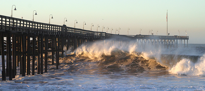
A recent study by the US Geological Survey took a sobering look at future risks from rising seas. The authors describe how storm surge, very high tides (popularly known as king tides), and large waves during storms can amplify the effects of sea level rise. They simulated coastal erosion and flooding over the next two centuries and found there could be dramatic increases in damages during modest storms, and catastrophic flooding during rare, large storms. These impacts are projected to appear by the middle of the 21st century, at a scale likely to significantly affect the state’s economy.

Beyond costly efforts to protect against coastal erosion and ocean flooding, coastal areas will also need to manage increased inland flooding. Large storms can amplify the effect of rising seas by bringing greater storm surge, particularly if these coincide with king tides. Storm runoff flowing down coastal creeks will meet rising waters caused by storm surge and tides, exacerbating flooding. This issue is particularly acute in parts of the Bay Area (including much of Silicon Valley) and low-lying areas in Southern California. Major new efforts to manage runoff and protect existing homes and businesses will be needed.

Sea level rise will also affect water management in other ways. One area is wastewater treatment. Throughout coastal California and particularly in the San Francisco Bay Area, wastewater and stormwater treatment takes place in facilities that are currently at or near sea level. The Bay Area alone is home to 30 such facilities that are vulnerable to damage by rising seas and storms.

Water supply will also be affected. Many coastal aquifers will see increases in salinity as sea levels rise and storms push saltwater farther inland. But the most significant impact on supply is likely to be associated with changes in the Sacramento‒San Joaquin Delta.

The Delta lies at the head of the San Francisco Bay estuary and the confluence of the Sacramento and San Joaquin Rivers. More than 25 million Californians and 3 million acres of farmland rely on the Delta for a portion of their water supplies. These exports are managed by large state and federal projects that pump water from the southern Delta.

Sea level rise affects the Delta in two ways. First, to keep its waters fresh enough so that cities and farms can use it, a certain amount of fresh water has to flow out of the Delta and into the San Francisco Bay. If the outflow is insufficient—whether due to drought, reduced inflows from upstream water use, or high export pumping—tides push saltwater into the Delta, making its water unusable.

The second way sea level rise will affect the Delta concerns the 1,100 miles of levees that line its channels. Levees hold water back from Delta islands, whose lands are now well below sea level due to sinking soils. Failure of these levees—particularly in the western Delta—can lead to changes in the way tides circulate water in the Delta. These changes amplify the increases in salinity from sea level rise alone; together, they put additional pressure on water supplies.

Addressing the many effects of sea level rise on California water management requires extensive planning and costly investments in infrastructure. The US Geological Survey study shows that these impacts are not in some distant future, but are likely to become significant in just a few decades. The good news is that state and local officials are starting to work on this problem, which will take many years to address.
Acting Locally to Address Sea Level Rise


The author is a member of the PPIC Water Policy Center research network.

October brought a preview of some of the climate risks that coastal regions face. Hurricane Matthew wreaked havoc from Haiti to the eastern seaboard and the West Coast’s first “atmospheric river” storm brought flood warnings in some areas. The risk of coastal flooding is growing as a warming climate causes more intense precipitation and a gradual rise in sea level from Earth’s melting ice sheets. Both worsen the effect of high tides and large storms.

We have a few decades and perhaps up to a century to adjust to sea levels that are at least three feet higher than they are today. Coastal communities can expect a host of costly and dangerous problems from storms, including flooded wastewater treatment plants, shoreline erosion, industrial facilities spilling chemicals into waterways, and water supply systems inundated by seawater. The effects of floods are projected to be the most costly part of climate change. Some estimates put the global losses at $1 trillion a year by 2050, or roughly two percent of global GDP.

Although seas are rising relatively slowly, change will not be gradual at the community level. A series of strong winter storms that combine high tides, large waves, and intense rainfall can radically reshape a community in a matter of days.

For California to adapt, every coastal community will need a plan that envisions a future with higher sea levels and greater risk of coastal erosion and flooding. The plans will need to outline specific projects needed to weather changing conditions over coming decades. Communities will need to figure out how to raise roads, buildings, and critical infrastructure, and ways to enhance natural protective systems, such as beaches. Some combination of building codes and assistance programs is likely to be necessary. So far, most California communities are in the early stages of planning to adapt to rising seas.

Research shows that increasing awareness and knowledge of hazards is not enough to head off losses from disaster. A complicating factor in adaptation planning is how to make the scientific information actionable at the local level.

One new approach shows promise. A UC Irvine program called FloodRISE is bringing together experts in flood disasters, engineering, and the social sciences with local experts and community members in a number of Southern California communities and Tijuana, Mexico. As part of that program, we’re working with decision makers, community groups, NGOs, and personnel from key departments such as public works, city planning, emergency management, and environmental resources. The teams work together to create advanced visualizations of flooding. Using the latest climate science and data, local knowledge and flood modeling technology, they focus on addressing specific issues that communities care about the most.

How well we manage the problem of rising seas will to some degree depend on funding choices we make now. My FloodRISE collaborator Richard Matthew, a political scientist and disaster expert at UCI’s Blum Center for Poverty Alleviation, notes that funding for planning and preventing disaster risks is dwarfed by the resources that pour into communities after disaster strikes. In the chaos of emergency management, decisions must be made quickly and with very limited information, which too often leads to wasteful spending. Allocating more funds to climate-risk planning efforts would not only help local communities prepare for a rising sea and coastal flooding—it could help reduce wasteful spending later.

Learn more

Read California’s Water: Preparing for Floods (from California’s Water briefing kit, October 2016)
Read “Floods in California” (PPIC Water Policy Center fact sheet, February 2016)
Visit the PPIC Water Policy Center’s floods resource page