Paying for Water’s “Fiscal Orphans”

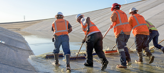
California’s water system is generally well funded and adequately maintained, but there are a few areas that lack a steady funding source. The most prominent of these “fiscal orphans” are safe drinking water for disadvantaged rural communities, flood management, stormwater management, and water for the environment. We talked to Dean Misczynski, an expert in infrastructure financing and an adjunct fellow with the PPIC Water Policy Center, about how to create a more reliable funding stream to address these problems.

PPIC: Are there better ways to pay for California’s underfunded “fiscal orphans”?

Dean Misczynski: Water is one of the easier things in government to pay for, because you can sell it. Local water fees and local taxes pay for most spending on water in California. State voter-approved general obligation bonds also play a pretty big role. But our thinking about how to use state bond acts developed sometime around the Civil War, and we could do a better job using bonds to fund 21st-century realities.

We currently use bond acts to raise the capital needed to build projects. But funding for the operation and maintenance costs of those projects is expected to come from somewhere else―or nowhere. No sensible business thinks this way; capital funding and operations and maintenance should be part of a unified financing plan. In addition to authorizing borrowing money for specified purposes, a state bond act could easily include ongoing expenses by appropriating money from the General Fund to pay for the operation and maintenance needed to make the project work. This approach would offer a more business-like, coherent financing plan and give voters a more honest look at what the undertaking would really cost.

To be clear, the operations and maintenance budget would not be part of the borrowing authorized by the bond act, because that would be an expensive way to pay for ongoing costs. But the funding would be earmarked and committed for the long term. And note that this doesn’t call for a new tax or fee; it just requires an ongoing commitment to use some General Fund dollars to cover the ongoing costs. In this way it’s similar to the bond itself—repayment comes from the General Fund, which ultimately comes from existing taxes.

PPIC: What types of issues would this approach be especially appropriate for?

DM: It’s best in situations where there aren’t good ways to cover operations and maintenance for projects funded by the bond. If we were to take this idea seriously, we’d want to do some careful thinking to identify the most legitimate uses of this new authority and to caution against using it for unnecessary or unwise purposes.

So, for example, a relatively well-off community getting a bond-funded project wouldn’t need state money for ongoing expenses. But for a water system in a very poor community, this type of funding mechanism could be very useful. There are a number of small, disadvantaged communities in the Central Valley that can’t afford to upgrade or maintain parts of their water system and that lack safe drinking water as a result. They might be good candidates.

These types of appropriations could also pay for ongoing expenses for projects that are important and have political support, but are easy targets for cuts during the state’s inevitable next recession. Two examples that come to mind are maintaining watershed areas, and data collection and analysis to improve water management.

This approach wouldn’t just be useful in the context of water—it could help with the transportation sector, low-income housing, and other statewide challenges. And it could be used as a model for local bond funding as well.

How “Weather Whiplash” Could Change California

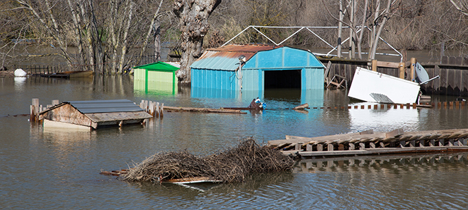
First came the drought, then the floods: California has long bounced between the two weather extremes―most recently when the latest drought segued into 2017’s record-breaking rain and snow. Such “weather whiplash” could become much more common as the climate changes, according to a new study. We talked to Daniel Swain, a climate scientist at UCLA—and the study’s lead author—about what to expect.

PPIC: California already has a highly variable climate. How will this be different?

Daniel Swain: There will be much bigger swings between wet and dry years. We project a 25–100% increase in extreme swings in this century. On top of that we’ll probably see some changes in seasonality. While it will still be dry in summer and wet in winter, spring is likely to become considerably drier in most of the state, especially in the south. This will have big consequences for things like the snowpack and wildfire risk.

California’s human and natural systems can usually withstand the kind of variations we’ve seen in the past. But as the frequency and intensity of these swings increases, it could push some species to the edge. For example, the warming climate is already stressing our forests faster than they can adapt—we’re seeing a dramatic example of this right now with widespread Sierra Nevada tree mortality. And warming temperatures are making it difficult to manage for salmon and other fishes that rely on cold water.

It could be equally hard for the state’s water system to adapt to the bigger floods. Our big dams were designed to capture smaller floods than what we expect in the future. We can make some changes on the margins, but these structures were built for a climate that we no longer have.

PPIC: What is the most surprising thing about your findings?  

DS: We were surprised by how much the risk for really severe flood events increases. We project a 300–400% increase in the likelihood of events similar to California’s 1862 Great Flood, which brought weeks of unrelenting rain and inundated much of the Central Valley. We found that it’s more likely than not that an event comparable to the 1862 flood will occur in the next 40–50 years. Keep in mind that there’s no modern precedent for this—it would exceed all previous tests of our flood management infrastructure.

It’s important to remember that we based our study on fairly pessimistic assumptions. If the world greatly reduces greenhouse gas emissions, California could see a smaller increase in extreme flood risk. But social and political factors will ultimately determine how much we reduce emissions in coming decades, so uncertainty remains.

PPIC: What is the key takeaway for water managers?

DS: We need to think about managing droughts and floods simultaneously, because some adaptations to help manage drought could make it harder to manage floods and vice versa. For example, increasing water stored behind California’s big dams gives us a nice buffer against a couple years of drought. But this saved water can become a liability because it reduces the reservoir space available to capture flood water. A higher risk of big floods necessitates bigger safety margins, which means storing less water behind dams for dry times.

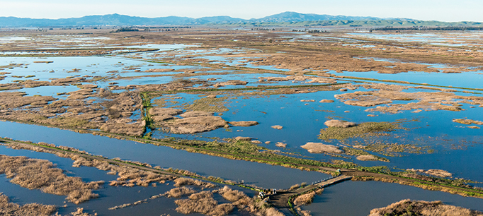
One way to help manage this trade-off is to increase the use of natural floodplains to take up some of the water from big storm events. For example, Sacramento’s Yolo Bypass is intentionally inundated to protect the city from big floods. Another approach is to capture the water released from dams to make space for floods and store it underground. And when floods inevitably come, use flood waters to recharge groundwater.

How Oroville Is Changing Dam Safety in California

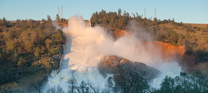
California’s 1,500 dams are regularly inspected and most have been safe for generations. Before last year’s Oroville Dam spillway crisis, the last dam disaster was the deadly 1928 Saint Francis Dam failure in Southern California. But the scale and drama of the Oroville crisis jolted the state into action, resulting in a stream of safety reviews, forensic analyses, and policy changes.

Within weeks of Oroville’s spillway incident, Governor Brown announced a 4-point plan to bolster dam safety and flood protection. And with the enactment of Senate Bill 92, a new dam safety regime has strengthened the state’s existing system.

We asked two experts about the lessons of Oroville for dam safety in California: Jeff Mount, a senior fellow at the PPIC Water Policy Center and an expert in hydrology and geology; and Jay Lund, director of the Center for Watershed Sciences at UC Davis, a member of the National Academy of Engineering, and an adjunct fellow at PPIC.

“First, we have to do a more complete job of assessing infrastructure,” said Lund. “We need to look for potential cascades of failures, which is what happened at Oroville. And we need to look at all of the outlet structures, which are essentially a dam’s safety valves.”

He noted that all federally regulated dams are subject to safety analysis every seven years, “yet they didn’t pick up the problems of Oroville. The lessons here are that you can never stop worrying about infrastructure and that we have to be prepared for things to fail.”

Mount seconded the need to stay vigilant, noting, “Water has a way of finding weaknesses in planning, design, and maintenance. If you miss something, eventually water will find a way to tell you so.”

Another new dam safety bill, Assembly Bill 1270, requires the state to consult with independent experts to update dam safety practices every 10 years. Lund said that will encourage the use of new kinds of technologies and practices. “But I think more important than the law itself is the culture of the people in charge of dams and dam safety, and whether they’re given the right resources and the mission to do more thorough assessments of old problems lurking in these structures.”

Mount noted that climate change is a complicating factor. “The inspections and upgrades are a good start,” he said. “But many of our dams―including Oroville―were designed more than 50 years ago. We need to evaluate how to operate them under changing hydrologic conditions.”

He added that many large dams try to fulfill multiple, conflicting objectives. “For example, a flood manager wants an empty reservoir during flood season while a water supply manager wants to fill the reservoir as much as possible. We’ll need to take a second look at how we manage dams for competing objectives and will likely face some tough trade-offs.”

Oroville also raises the question of how to pay for dam safety over the long term. “The Oroville episode will probably end up costing slightly less than $1 billion,” Lund said. “At 5% interest, that’s $50 million a year. A $50 million annual flood safety program might have avoided this. There is probably a good financial argument to increase spending on maintenance and inspection of major infrastructure.”

Why We Need Working Floodplains

Floodplains are hard-working landscapes when they’re allowed to “act naturally.” But their flood-taming, habitat-feeding abilities are compromised when they’re paved over or constricted by levees. We talked with Josh Viers, a watershed scientist at UC Merced and a member of the PPIC Water Policy Center research network, about restoring floodplains.

PPIC: What happens when rivers are given more room to flood?
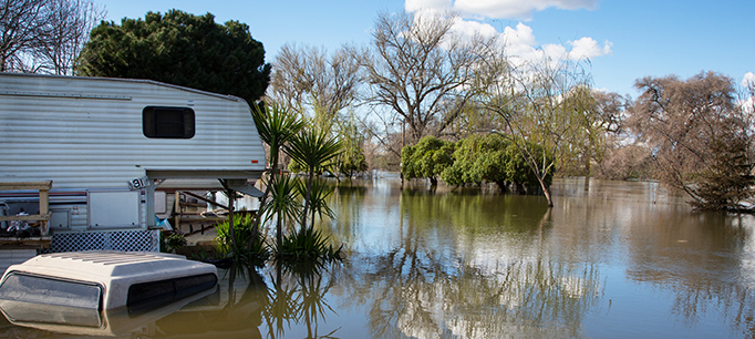
Josh Viers: River systems are highly dynamic—they’re always changing in time and space. As they rush from their headwaters, they break down mountains and transport a lot of sediment. By the time they reach the lowlands, they’ve started to deposit that sediment. It’s that dynamic between water and land that creates floodplains. Humans like to inhabit floodplains because of their rich soil and flat land. So we’ve engineered ways to protect people from floodwaters. But ecosystems evolved to have functions and processes that depend on floods. For example, flood flows are slower and warmer on floodplains. That creates good conditions for a lot of creatures―bugs, fishes, and birds, for example. When we cut off rivers from their floodplain, we’re cutting off these essential habitat functions.

We now recognize that giving rivers room to flood can have many beneficial outcomes. Dynamic river systems that are allowed to flood result in more complex habitats and more productive ecosystems. There’s a growing effort to reconnect floodplains to their rivers—for example, by setting back or breaching sections of levees. The most immediate benefit is a reduction in flood hazards downstream because you store some floodwater and some of the sediment that constricts channels on the floodplain. There are also ecosystem benefits. As more nutrient-rich sediments are deposited on the floodplain, they’re colonized by riparian plants, feeding whole communities of insects, birds, and other animals. Floodplains are also incubators for native fishes. Fishes on floodplains get much fatter than those that remain in the river, which can translate into better reproductive success. Floodwaters in floodplains can also recharge local groundwater supply, and they facilitate the long-term sequestration of carbon by burying plant matter with sediments deposited on the floodplain.

PPIC: Where is floodplain restoration underway?

JV: I’ve been part of a team of scientists looking at floodplain restoration on the Lower Cosumnes River near Sacramento. This river has no major dam on it so it has a relatively natural flow regime, including relatively frequent floods. We’ve studied how its floodplain responds to reconnection with flood waters after its levees were set back. And we’ve documented that setting back levees and allowing rivers to flood have multiple benefits for habitat and groundwater recharge while maintaining flood protection. The lessons from the Cosumnes are informing similar efforts in other locations—the Sacramento, San Joaquin, and Feather rivers are having some levees set back in strategic locations.

One of the more remarkable recent floodplain restoration projects is located at the confluence of the San Joaquin and Tuolumne rivers. Federal and state agencies have worked with landowners and conservation organizations to integrate flood protection and habitat creation through levee enhancements and the acquisition of key floodplain lands. The results have not only benefitted fish and bird populations, but also provided room for the rivers to behave more naturally in a location that has historically had large river meanders and complex features such as oxbows and sloughs―habitats that are now rare in the San Joaquin Valley.

PPIC: What’s slowing floodplain restoration in California?

JV: There are a number of obstacles. A big goal for these projects is to maintain or improve flood hazard reduction. So permitting processes can require fairly sophisticated studies that take time and money. They also have to undergo the same environmental review as any other construction project. And financing is a big hurdle. A few decades ago, floodplain restoration projects were fairly simple. Today, projects are bigger and more sophisticated, so costs have gone up. Also, projects can be hampered by urbanization, unwilling landowners, or poor conditions on the ground. That said, there are thousands of miles of levees and hundreds of miles of rivers, and many more places where we could do floodplain restoration.

Learn more
Read Floods in California (PPIC fact sheet)
Read “The High Cost of Fixing Levees” (PPIC Blog)
Visit the PPIC Water Policy Center flood resources page


Flood Prevention 101: Stay Out of the Floodplain

What did the catastrophic hurricane season of 2017 tell us about how we’re managing flood risk? We talked to Nicholas Pinter—a flood and floodplains expert at the UC Davis Center for Watershed Sciences and a member of the PPIC Water Policy Center research network―about improving flood management.

PPIC: Why did Hurricane Harvey result in so much damage to Houston?

Nicholas Pinter: Houston has had very bad land use planning—it is built on flood-prone land, and its inadequate storm drainage makes flooding worse. Combine these glaring flood-management flaws with the unprecedented rainfall that Harvey brought and you’ve got a truly epic flood disaster. Harvey’s damage is clearly a product of both human choices and the storm’s intensity.

The number and magnitude of recent extreme storms are consistent with predictions for a changing climate. There’s a nagging feeling among some of us who study flood disasters that maybe we’ve reached a sort of tipping point, with short-duration storms dumping unprecedented rainfalls.  Harvey may be an example of this.  And if it is happening, our window of opportunity to improve flood systems may be shrinking.

PPIC: What are your top priorities for reducing flood risk?

NP: One thing that scientists, floodplain managers, and many politicians agree on is that we must limit floodplain development. A lot of the damage from Harvey was supposed to be prevented by the National Flood Insurance Program (NFIP). But the program failed in Houston in large part due to the failure of its primary goal—to discourage development in floodplains.

With the enactment of the NFIP in 1968, the US government agreed to provide subsidized flood insurance in exchange for local controls on building in floodplains. Communities that prohibit development on their floodplains can get underwritten insurance through the program (private flood insurance options are very limited).

But enforcement of the NFIP’s floodplain rule is very mixed across the US. A good example is Illinois. For the past 25 years, that state has aggressively enforced floodplain regulations and limitations. On other end of spectrum is Texas, where they embraced development and seemed to see floodplain limitations as job killers. Differences in enforcement explain many of the documented differences in flood damages and flood resilience.

PPIC: How are we doing on flood management in California?

NP: California is doing a lot of things right, and is learning from its past mistakes. A lot of money has been invested in improving levees. California is enforcing NFIP standards and trying to limit new construction on its floodplains (though with exceptions). But the Oroville crisis was a big wake-up call. If the emergency spillway had failed—and we were within hours of it—Oroville could have been a lethal disaster similar to Katrina. All eyes are now on aging dams as well as levees.

One issue I’d like to see improvement on is flood insurance. While many other states are net recipients of NFIP, California receives something like 14 cents on every dollar it pays in premiums to the program.  This appears to reflect California’s more rigorous effort to limit flood damage in its floodplains.

FEMA (the Federal Emergency Management Agency) recognizes wide differences in NFIP enforcement nationwide and has proposed a national disaster deductible to push back on states with poor enforcement and benefit those doing a good job. A second option being considered is a state-by-state rating system. And yet another option is for California to create its own flood insurance vehicle.

PPIC: Is there an argument for learning to live with flooding and rebuild after disaster strikes?

NP: A century ago the strategy was largely to live with floods. People clustered near rivers and had a tolerance for getting their feet wet occasionally. Fast forward to current times: a big leap in the density and value of infrastructure has greatly diminished that tolerance.

It’s very easy to creep forward gradually onto floodplains and much harder to back away from the flood hazard this brings. So the first and most valuable lesson is to stop creeping forward and strictly limit new floodplain development.  In some cases, opportunities exist to set back levees and reconnect rivers to their floodplains. These kinds of efforts often can provide valuable, multi-layered benefits.

What Recent Hurricanes Mean for Flood Insurance in California

Three exceptional hurricanes—Harvey, Irma, and Maria— caused staggering damages from floods, winds, and storm surge in recent weeks. It’s likely they will make the record books as the most costly natural disasters in US history.

Although California doesn’t get hurricanes, it does get large storms (called “atmospheric rivers”) that can be just as damaging to people and property. Currently, one in five Californians and close to $600 billion worth of structures are vulnerable to flooding.

One way for residents and businesses to reduce the financial risks of flooding is to carry insurance. Millions of Californians depend on the National Flood Insurance Program (NFIP), managed by the Federal Emergency Management Agency (FEMA). But at almost 50 years old—and facing an uncertain reauthorization this December—it has many problems.

The most immediate concern is the imbalance between premiums and claims. Currently, the NFIP is more than $25 billion in debt―a figure that will certainly grow once all the recent hurricane claims are processed.

“The program never charged prices that would cover a year like Hurricane Katrina, where it paid out more than it had over the life of the program.  And the string of storms since then—Ike, Sandy, and now Harvey, Irma, and Maria—have only worsened its debt,” says Carolyn Kousky, director of policy research for the Wharton Risk Center and a member of the PPIC Water Policy Center research network.  “Realistically, the program will not be able to repay this debt, so the best thing may be for Congress to simply forgive it, while also putting in place a new approach to pay for catastrophic events.”

Another problem is that too many people at risk of flooding do not enroll in the program. In Houston, approximately 80% of Harvey-flooded homes were not insured.  And here in California, just 10% of flood-prone Sacramento county households and only half of those in high-risk areas have flood insurance.  Among the reasons so few people purchase insurance, Kousky says, are “unwillingness or inability to pay, a misunderstanding about the role of insurance, an unsubstantiated faith in disaster aid, and importantly, no information or even misinformation on flood risks.”

Inadequate perception of risk stems, in part, from the way FEMA maps flood hazards and mandates insurance. Currently, FEMA requires (but does not sufficiently enforce) flood insurance for homes with a 1-in-100 chance of flooding in any given year (the so-called 100-year flood). For homes in the floodplain but out of this high-risk zone, insurance is optional.

Nicholas Pinter—the associate director of the UC Davis Center for Watershed Sciences and a member of the PPIC Water Policy Center research network―notes that this gives a false impression that those outside this zone are safer than those within it. His laboratory found that roughly half the flooding from Harvey was outside of Houston’s 100-year floodplain zone.

“The picture in California is much better than in Texas,” Pinter says. “But updating flood maps here still takes many years, and California still largely works within FEMA’s framework of the ‘all or nothing’ 100-year floodplain.”

But the state may not be getting a good deal from the NFIP.  According to Pinter, California pays much more into the program than it is getting back.  He notes that California has gotten just 14 cents in return for every dollar of premiums paid.  The Central Valley—the most flood vulnerable area of the state—got just 9 cents per dollar.

“For a variety of reasons, California may be overpaying for its actual flood risk,” Pinter suggests. “The state needs to explore whether it is cheaper to develop its own flood insurance program and to invest the savings—estimated to be at least $150 million per year—in reducing flood risk across California.”

With this year’s unprecedented string of flood disasters and uncertainty for national insurance, it’s time for real policy reforms to ensure Californians are prepared to weather the growing risk of floods. Fixing our flood insurance problems is one way to start.

Learn more
Read Floods in California (PPIC fact sheet, September 2017)
Watch our 3-minute video “Floods”
Read Financing Flood Losses by Carolyn Kousky (February 2017), and her related blog post, “Flooding and the Economics of Risk Reduction” (August 30, 2017)

Californians Favor Funding Flood Improvements

California’s very wet winter has revealed both literal and figurative cracks in the state’s flood management infrastructure. While most flood-related problems this year didn’t reach the level of the Oroville Dam spillway disaster, public concern about California’s aging flood infrastructure is growing—including how to pay for upgrades.

According to the latest PPIC statewide survey, 61% of Californians say that more spending on water and flood management infrastructure is very important for their part of California. Only one in ten say it is not important. When we asked a similar question in October 2006, fewer than half (43%) said such spending was very important. Today, the view is widely held, with about majorities across partisan, racial/ethnic, age, education, and income groups saying so. Across regions of the state, majorities say more spending is very important, ranging from 56% in the San Francisco Bay Area to 65% in the Central Valley.

Governor Brown recently requested the appropriation of $437 million for flood control projects. The majority of the funds ($387 million) come from Proposition 1, the 2014 water bond devoted to investments in the state’s water systems. These funds would finance high-priority infrastructure projects―for instance, maintaining and improving Sacramento–San Joaquin Delta levees. Another $50 million of the governor’s proposal would come from the general fund for ongoing emergency needs and would cover government agency coordination and flood management equipment needs.

But even with this one-time infusion of dollars, the funding gap for flood management activities is large. Our earlier work, Paying for Water in California, estimates it at $800 million to $1 billion annually. This gap varies regionally, with areas located in floodplains needing higher levels of investment in flood-protection infrastructure.

Finding ways to close this gap will require us to rethink not only how we pay for flood infrastructure but also how we manage floods more generally. In fact, using flood management approaches that derive multiple benefits―for instance, to recharge groundwater basins and to restore ecosystems—could help improve the state’s ability to adapt to a changing climate. But just as floods are sporadic, so too is public interest in funding flood infrastructure projects. With the Oroville Dam crisis and San Jose flood still fresh in the minds of many Californians, the timing may be right to start a conversation about creating more stable financing mechanisms that can help us prepare for floods of the future.

Learn more

Visit the PPIC Water Policy Center flood resources page
Read California’s Water: Paying for Water (from California’s Water briefing kit, October 2016)

The High Cost of Fixing Levees

The crisis at Oroville brought dams to the forefront of state and national discussions about aging infrastructure. Now, as full dams release high flows into rivers hemmed in by levees, this element of the state’s flood management system is in the spotlight.

Many of our levees are very old—much older than most of the state’s dams—and in need of modernization. Nowhere in California is the issue more important—or more challenging—than in the Central Valley, and particularly, the Sacramento-San Joaquin Delta.

The levees of the Central Valley are being tested this winter by sustained high flows. Some have failed, resulting in evacuations—including along the Cosumnes and San Joaquin Rivers. More challenges are in store in the Delta as flood waters move downstream later this week and into the spring.

The scale of modernization needed to avoid damaging floods—particularly as the climate changes and population on the floodplain grows—is vast. At least 1,600 miles of levees line the rivers and flood bypasses upstream of the Delta, forming the federally authorized Central Valley Flood Control Project. The most robust levees in this project protect cities like Sacramento, involving hundreds of millions of dollars’ worth of upgrades. But most of the project has weak and outdated levees that are unreliable in large floods.

The Delta has its own unique network of more than 1,100 miles of levees, which ring islands that lie well below sea level. The Delta levees are the least reliable in the Central Valley and are under threat from sea level rise, continued sinking of the islands, and earthquakes.

The good news for Central Valley levees is that there is consensus that the system needs a substantial upgrade, and there has been significant progress in envisioning what that might entail. In 2006, the legislature instructed the Department of Water Resources to develop a comprehensive plan for improving flood management within the region. The Central Valley Flood Protection Plan—released in 2012 and updated every five years—identifies a range of options, including new infrastructure, updated operation systems, and land use changes that could improve flood protection for the Sacramento and San Joaquin Valleys.

In the Delta, a 2009 law instructed the Delta Stewardship Council to develop a plan for prioritizing state investments in levees, balancing local needs with statewide interests. A draft plan now under review is expected to be adopted later this year.

The bad news is that doing anything about these levees is going to be difficult for three reasons: it would be very expensive, take a very long time to implement, and be very controversial. The Central Valley plan has a price tag of $17–$21 billion over 30-plus years. For the Delta, the council has identified more than $2 billion in high-priority upgrades.

These costs far outstrip the resources of local flood management entities—particularly in the Delta, where low land values and farm revenues make it hard to generate funds for major upgrades. State bonds and some federal dollars have provided key support, but there is still a large gap—in the range of $800 million to $1 billion annually. Indeed, flood management remains one of the water sector’s most prominent “fiscal orphans,” with one of the biggest funding gaps compared to need.

State policymakers will need to assess what is achievable with known or likely resources and make tough choices about priorities based on state interests and public safety. This is not an easy task. There is usually strong local pressure to do something for as many people as possible with the limited funds available. While this approach appears equitable, it is unlikely to yield significant reductions in flood risk. Investments will need to be concentrated to be effective.

As noted in our recent blog post, the silver lining of this winter’s flooding is renewed attention to the urgent need to modernize the state’s flood management infrastructure. These discussions have begun in the legislature. Sustained leadership on this issue will be needed to sustain the urgency to act once the sun shines again. The good news is that the legislature has taken the all-important first step in tackling this difficult but very important problem.

Learn more

Visit the PPIC Water Policy Center flood resources page
Read California’s Water: Paying for Water (from California’s Water briefing kit, October 2016)

Yesterday’s Dams Face Tomorrow’s Floods

The crisis at Oroville Dam on the Feather River eased yesterday as state officials gained control over the damaged spillway and allowed the more than 180,000 evacuees to return home. Prospects are good that dam operators will be able to control releases through the remainder of the wet season. Now that the immediate crisis is past, we should take the opportunity to review how we manage California’s big dams—and what changes would help us do so more effectively in future.

Water—whether too much or too little—has a way of revealing weaknesses in design and decision making. For Oroville Dam—the tallest dam in the nation—the crisis began with poor maintenance of its main spillway compounded by wholly inadequate design of the emergency spillway, a known problem. But the crisis at Oroville also raise five broader concerns that California will have to reckon with:

  • Aging dams. Most of the state’s 1,400 large dams were designed using slide rules and based on simplistic assumptions about hydrology and earthquakes. These dams are marvels of engineering considering when they were built, but many are in need of major upgrades in infrastructure and operations. California needs a comprehensive plan for evaluating and modernizing these structures.
  • A changing climate. California’s dams must be adapted to address new risks from a changing climate. These dams were built to respond to early- to mid-20th century conditions. The climate has shifted since that time, and the bulk of climate simulations point to significant changes in the near future. Our dry periods are getting both drier and warmer, and our wet periods are getting wetter with more precipitation falling as rain rather than snow. Part of the problem at Oroville is that the warm temperatures have meant there’s more water to manage right now than usual because less of it is staying in the snowpack. The past seven years—which included five years of record warm, dry conditions bracketed by extremely wet ones—is a glimpse into our future. It is time to rethink how we are going to operate and maintain our dams to respond to these changes.
  • Conflicting goals. We may be asking too much of our dams. For example, Oroville Dam provides water supply, hydropower, flood management, recreation, and ecosystem flows for rivers and the Delta. Flood management is in tension with the other services because a mostly empty reservoir—bad for the other services—is the best hedge against floods. By design, Oroville was relatively full when the latest floods arrived, reflecting its top priority (water supply) and compounding flood risk. It may be time to rethink the balance of objectives for all of our large, multipurpose dams.
  • Rigid rules. Adjusting course on dams—whether by changing the infrastructure or the way they are operated—is difficult. Licenses for non-federal dams like Oroville—administered by the Federal Energy Regulatory Commission—last for 30–50 years. These lock in place all aspects of dam operation for several generations and require herculean efforts to overcome. Moreover, flood operations on all dams are mandated by the US Army Corps of Engineers and require an act of Congress to change. When it comes to changing course on dams, institutional inertia is a powerful countervailing force.
  • High cost of improvements. Any change in course is likely to be very expensive. California relied heavily on federal support for construction of many of its large, multipurpose dams. Support ended decades ago and is unlikely to resume in the future. California is going to need a comprehensive funding plan for modernizing its dams and other flood management systems that does not rely on extensive federal support.

Most water crises have a silver lining. The recent drought spurred changes to the way we manage water scarcity in the state, resulting in one of the most important pieces of water legislation—the Sustainable Groundwater Management Act—in many decades. The crisis at Oroville should spur Californians to rethink how we manage our network of large dams. New management approaches, new technology, and new investments to modernize dams will be necessary to adapt to changing conditions, both today and tomorrow.

Learn more

Visit the PPIC Water Policy Center flood resources page
Read California’s Water: Climate Change and Water (from California’s Water briefing kit, October 2016)

From Drought to Deluge

The recent change in the weather is prompting many Californians to shift their worry over drought to fretting about floods. That’s an understandable response to California’s volatile climate, which is the most variable in North America. Most notable this year is the return of atmospheric rivers—river-like bands of moisture that periodically stream into California, often from the tropics. These storms are responsible for most of our large, devastating floods. They are also critical for our water supply, providing roughly half of our precipitation in normal and wet years. When atmospheric rivers don’t occur, we usually have a drought.

Here are a few key takeaways from this welcome stretch of wet weather:

  • This is likely to be the end of the surface-storage drought for most of the state. In other words, by next week almost all the major reservoirs will be at or above their seasonal averages (there’s a good summary here)—conditions we have not seen in six years. This is great news since reservoirs are the primary source of water for cities and farms.
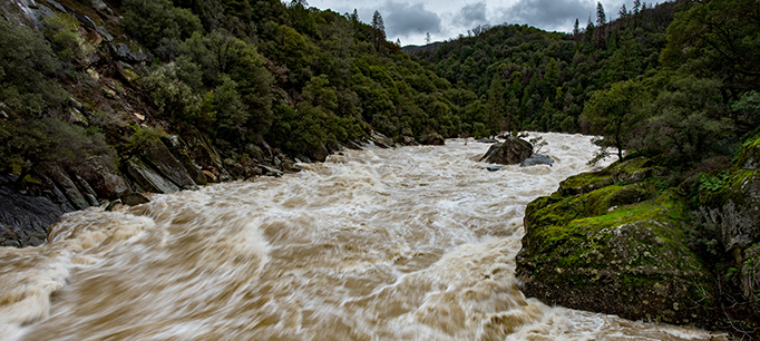
  • Many multipurpose reservoirs—those that supply water, hydropower, and flood storage—are well above historic averages. To maintain their flood management capacity for future winter storms, these reservoirs are required by federal rules to release large amounts of water, which is why so many rivers below dams are running high.
  • It is reasonable to be optimistic that our reservoirs will fill this spring. We rely on melting snowpack to top up reservoirs in the spring and to provide roughly a third of the state’s water supply in an average year. The warmth of the weekend storms washed away some of this snowpack, particularly in the middle elevations of the Sierra Nevada (5,000–7,000 feet). Still, higher elevations accumulated a great deal of new snow with these storms, and more than two months remain in the winter snow season.
  • One wet year is not a drought buster. During the height of the drought, the state’s farmers and others turned to groundwater pumping to make up for surface water shortages. The water deficit in our aquifers is now immense. For example, in 2014 and 2015, surface water supplies to farmers in the Central Valley were cut nearly in half, causing them to make up most of this reduction through additional groundwater pumping or land fallowing. It would take many successive wet years—and more intentional groundwater capture and storage—to restore aquifers to the condition they were in before the onset of drought.

The wet beginning to 2017 is a welcome relief from the past five dry years. Full surface reservoirs take pressure off water users and water regulators. But the rains did not wash away California’s major water challenges. There are big decisions ahead—many to be made this year—about how to sustainably manage groundwater, improve storage, resolve the problems of the Delta, and arrest the decline of our native fish and wildlife. Maintaining momentum on these issues is as critical now as when the reservoirs were low.

Learn more

Read California’s Water (PPIC briefing kit, October 2016)
Visit the Policy Priorities for California’s Water YouTube page
Visit the PPIC Water Policy Center flood resources page

Photo by Carson Jeffres